File:Map of King City, 1878.jpg
Original file (346 × 704 pixels, file size: 106 KB, MIME type: image/jpeg)
Captions
Captions
Summary
edit
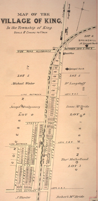
| Description |
English: A map of King City, Ontario from Illustrated historical atlas of the county of York and the township of West Gwillimbury & town of Bradford in the county of Simcoe, Ont.
Toronto : Miles & Co., 1878. |
| Date | |
| Source | Town of King at the Canadian County Atlas Digital Project |
| Author | Miles & Co. |
Licensing
edit
|
This work is in the public domain in its country of origin and other countries and areas where the copyright term is the author's life plus 70 years or fewer.
| |
| This file has been identified as being free of known restrictions under copyright law, including all related and neighboring rights. | |
File history
Click on a date/time to view the file as it appeared at that time.
| Date/Time | Thumbnail | Dimensions | User | Comment | |
|---|---|---|---|---|---|
| current | 00:25, 13 February 2012 | | 346 × 704 (106 KB) | Mindmatrix (talk | contribs) | {{Information |Description ={{en|1=A map of King City, Ontario from ''Illustrated historical atlas of the county of York and the township of West Gwillimbury & town of Bradford in the county of Simcoe, Ont.'' Toronto : Miles |
You cannot overwrite this file.
File usage on Commons
The following page uses this file:
- File:Yor-m-king.jpg (file redirect)
File usage on other wikis
The following other wikis use this file:
- Usage on en.wikipedia.org