File:Yukaghir map.svg

Size of this PNG preview of this SVG file: 715 × 353 pixels. Other resolutions: 320 × 158 pixels | 640 × 316 pixels | 1,024 × 506 pixels | 1,280 × 632 pixels | 2,560 × 1,264 pixels.
Original file (SVG file, nominally 715 × 353 pixels, file size: 928 KB)
Captions
Captions
Add a one-line explanation of what this file represents
Summary edit
| Description |
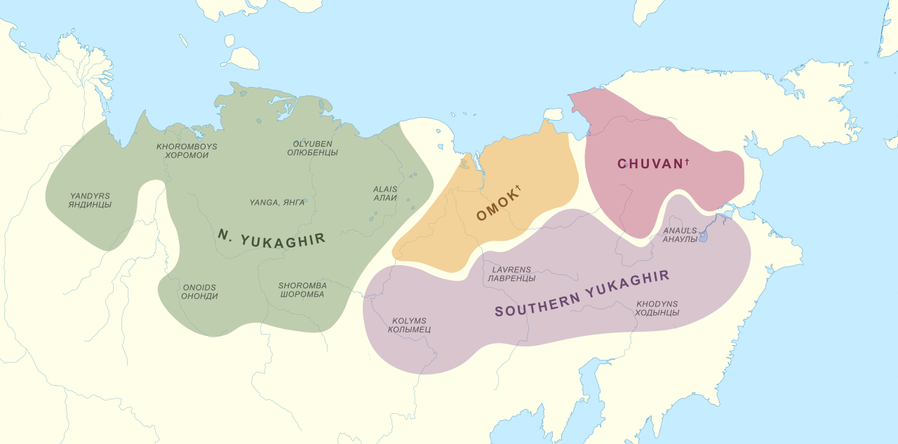
English: Map of the Yukaghir languages and tribal divisions in the 17th century.
This file was derived from: Outline Map of Far Eastern Federal District.svg Sources:
|
| Date | |
| Source | Own work |
| Author | Noahedits |
![[3]](https://i.redd.it/3of4ig867ni41.jpg)
![[5]](https://rai.onlinelibrary.wiley.com/cms/asset/8ab11404-d32d-428e-aa60-7e2fda64f378/jrai_205_f1.gif)
Licensing edit
I, the copyright holder of this work, hereby publish it under the following license:
This file is licensed under the Creative Commons Attribution-Share Alike 4.0 International license.
- You are free:
- to share – to copy, distribute and transmit the work
- to remix – to adapt the work
- Under the following conditions:
- attribution – You must give appropriate credit, provide a link to the license, and indicate if changes were made. You may do so in any reasonable manner, but not in any way that suggests the licensor endorses you or your use.
- share alike – If you remix, transform, or build upon the material, you must distribute your contributions under the same or compatible license as the original.
File history
Click on a date/time to view the file as it appeared at that time.
| Date/Time | Thumbnail | Dimensions | User | Comment | |
|---|---|---|---|---|---|
| current | 23:49, 20 May 2020 | | 715 × 353 (928 KB) | Noahedits (talk | contribs) | Uploaded own work with UploadWizard |
You cannot overwrite this file.
File usage on Commons
There are no pages that use this file.
File usage on other wikis
The following other wikis use this file:
- Usage on de.wikipedia.org
- Usage on en.wikipedia.org
- Usage on fr.wikipedia.org
- Usage on ja.wikipedia.org
- Usage on lij.wikipedia.org
- Usage on pt.wikipedia.org
- Usage on zh.wikipedia.org