File:Zandvoort.svg

Size of this PNG preview of this SVG file: 716 × 600 pixels. Other resolutions: 287 × 240 pixels | 573 × 480 pixels | 917 × 768 pixels | 1,222 × 1,024 pixels | 2,445 × 2,048 pixels | 1,042 × 873 pixels.
Original file (SVG file, nominally 1,042 × 873 pixels, file size: 50 KB)
Captions
Captions
Add a one-line explanation of what this file represents
Summary
edit| Description |
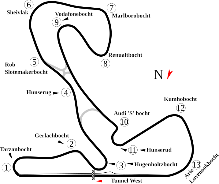
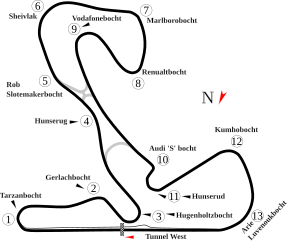
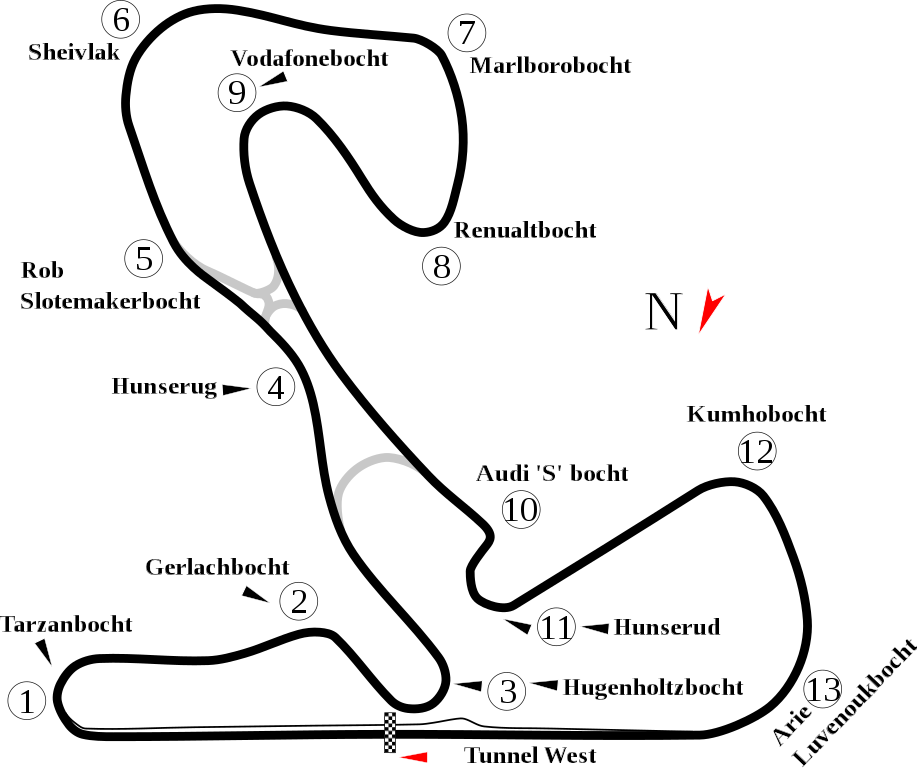
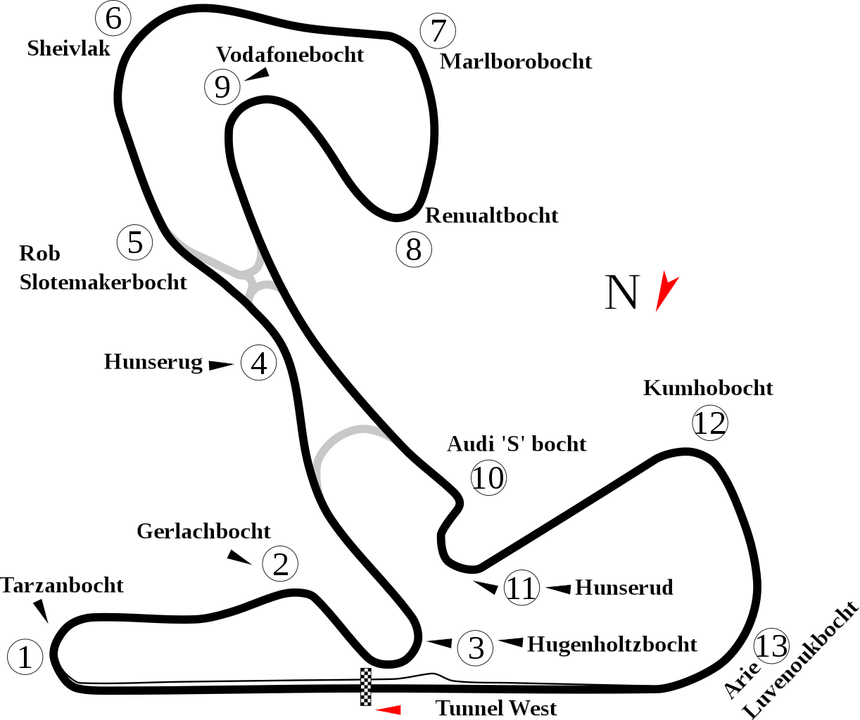
English: Track map for Circuit Park Zandvoort. |
| Date | |
| Source | Own work |
| Author | Will Pittenger |
| Other versions |
|

| Camera location | | View this and other nearby images on: OpenStreetMap |
|---|
Licensing
edit
| I, the copyright holder of this work, release this work into the public domain. This applies worldwide. In some countries this may not be legally possible; if so: I grant anyone the right to use this work for any purpose, without any conditions, unless such conditions are required by law. |
File history
Click on a date/time to view the file as it appeared at that time.
| Date/Time | Thumbnail | Dimensions | User | Comment | |
|---|---|---|---|---|---|
| current | 19:01, 14 August 2011 | | 1,042 × 873 (50 KB) | Sentoan (talk | contribs) | Actual usually track |
| 06:34, 18 July 2008 |  | 1,042 × 873 (49 KB) | Will Pittenger (talk | contribs) | {{Information |Description={{en|1=Track map for w:Circuit Park Zandvoort.}} |Source=Own work by uploader |Author=Will Pittenger |Date=7-18-2008 |Permission= |other_versions=<gallery>Image:Circuit Zandvoort.png|Old image &mdash |
You cannot overwrite this file.
File usage on Commons
The following 6 pages use this file:
File usage on other wikis
The following other wikis use this file:
- Usage on ast.wikipedia.org
- Usage on cs.wikipedia.org
- Usage on en.wikipedia.org
- Masters of Formula 3
- 2006–07 A1 Grand Prix of Nations, Netherlands
- List of A1 Grand Prix circuits
- 2007–08 A1 Grand Prix of Nations, Netherlands
- User talk:Chubbennaitor/archive2
- User talk:Barkjon/Archive 2
- Wikipedia:WikiProject Formula One/Newsletter/200808
- User talk:Hellboy2hell/archive2
- User talk:NapHit/Archive 1
- 2008–09 A1 Grand Prix of Nations, Netherlands
- User talk:4u1e/archive5
- User talk:Typ932/Archive 3
- User talk:Midgrid/Archive 6
- User talk:Thelb4/Archive 5
- User talk:Chubbennaitor/Archive7
- User talk:Readro/Archive 3
- User talk:Donnie Park/Archive 1
- User talk:The359/Archive 4
- FIA WTCR Race of the Netherlands
- 2009 Masters of Formula 3
- User talk:Cs-wolves/Archive 3
- 1999 Masters of Formula 3
- 2000 Masters of Formula 3
- 2001 Masters of Formula 3
- 2002 Masters of Formula 3
- 2003 Masters of Formula 3
- 2004 Masters of Formula 3
- 2005 Masters of Formula 3
- 2006 Masters of Formula 3
- 2010 Masters of Formula 3
- User talk:Bam123456789/Archive 1
- 2011 Masters of Formula 3
- 2012 Masters of Formula 3
- User talk:Sage Callahan/Archive 1
- User talk:Cdhaptomos/Archive 1
- 2013 Masters of Formula 3
- 2014 Zandvoort Masters
- 2015 Masters of Formula 3
- 2015 Blancpain Sprint Series Zandvoort round
- User talk:Spenalzo/Archive/2008
- User talk:Clyde1998/Archive/2008
- 2016 Masters of Formula 3
- List of FIA World Touring Car Championship circuits
- Usage on es.wikipedia.org
- Usage on fi.wikipedia.org
View more global usage of this file.