File:Zeeland NASA.jpg

Size of this preview: 600 × 600 pixels. Other resolutions: 240 × 240 pixels | 480 × 480 pixels | 768 × 768 pixels | 1,024 × 1,024 pixels | 2,048 × 2,048 pixels | 3,600 × 3,600 pixels.
Original file (3,600 × 3,600 pixels, file size: 3.16 MB, MIME type: image/jpeg)
Captions
Captions
Add a one-line explanation of what this file represents
| Description |
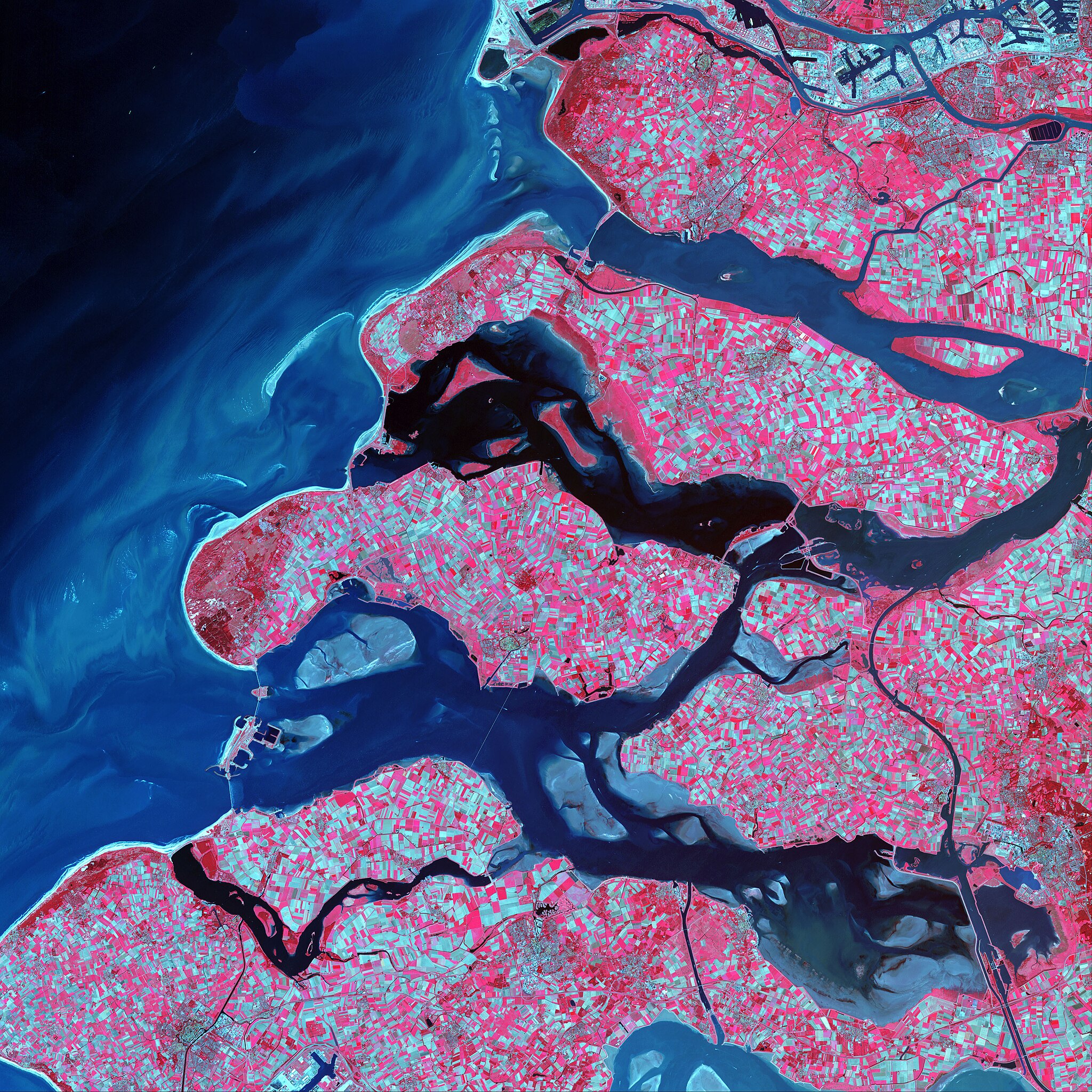
English: Along the southern coast of the Netherlands, sediment-laden rivers have created a massive delta of islands and waterways in the gaps between the coastal dunes. After unusually severe spring tides devasted this region in 1953, the Dutch built an elaborate system of dykes, canals, dams, bridges, and locks to hold back the North Sea.
This scene was acquired on May 24, 2002, by the Advanced Spaceborne Thermal Emission and Reflection Radiometer (ASTER) aboard NASA’s Terra satellite. This false-color composite was created by combining infrared, near-infrared, and red (ASTER bands 3, 2, and 1) wavelengths. The darker the red shown here, the more densely vegetated the terrain. The light blue-green areas show bare land surface. The North Sea appears black in this scene and trends from dark blue to lighter blue as the seawater carries increasingly more sediment near the surface. |
|||||
| Date | ||||||
| Source | http://earthobservatory.nasa.gov/IOTD/view.php?id=4563 | |||||
| Author | NASA | |||||
| Permission (Reusing this file) |
|

File history
Click on a date/time to view the file as it appeared at that time.
| Date/Time | Thumbnail | Dimensions | User | Comment | |
|---|---|---|---|---|---|
| current | 12:28, 26 September 2011 | | 3,600 × 3,600 (3.16 MB) | Lymantria (talk | contribs) | {{Information |Description={{en|Along the southern coast of the Netherlands, sediment-laden rivers have created a massive delta of islands and waterways in the gaps between the coastal dunes. After unusually severe spring tides devasted this region in 195 |
You cannot overwrite this file.
File usage on Commons
There are no pages that use this file.