Ilha de Moçambique
small island off mainland Mozambique
Depicted place: Ilha de Moçambique, Mozambique, Africa
-
 A map engraved by Pieter van den Keere in 1598
 -
 Chart of the Harbour in 1810
 -
 The 3.8-kilometre-long (2.4 mi) Mozambique Island Bridge
 -
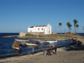
 Old Hospital
 -
 Church of Santo António
 -
 Beach cleaning
 -
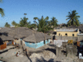 Makuti Town
 -
 Mosque
 -
 Ilha de Mocambique seen from Fort San Sebastiao, in background the bridge connected to the mainland
 -
 Avenida Avenida Amílcar Cabral
 -
 obelisk
 -
 Praça dos Heróis Moçambicanos
 -
 Banyan Trees

_Chart_of_the_Harbour_of_Mozambique.jpg)


.jpg)

.jpg)
small island off mainland Mozambique  .jpg)  | |||||
| Upload media | |||||
| Instance of | |||||
|---|---|---|---|---|---|
| Named after |
| ||||
| Location | Ilha de Moçambique District, Nampula Province, Mozambique | ||||
| Located in or next to body of water | |||||
| Heritage designation |
| ||||
| Length |
| ||||
| Population |
| ||||
| Area |
| ||||
 | |||||
|
This place is a UNESCO World Heritage Site, listed as
Island of Mozambique.
|