Regent's Canal
canal across an area just north of central London, England
Regent's Canal is a canal across an area just north of central London, England. It provides a link from the Paddington arm of the Grand Union Canal, just north-west of Paddington Basin in the west, to the Limehouse Basin and the River Thames in east London. The canal is 13.8 kilometres (8.6 miles) long.
Views on the canal
edit-
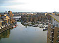
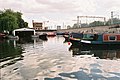
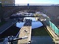 Lock, Limehouse Basin
 -
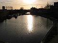
 Sunset, Camden Lock
 -

 The Regent's Canal near St Mark's Regents' Park
 -
 Camden Lock
 -
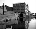
 Nicholas Grimshaw flats, Camden
 -
 Canal at St Johns Wood
 -
 Regents canal at dusk, St Pancras
 -
 St Pancras Cruising Club
 -
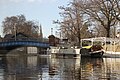
 Camden lock
 -
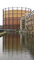 Gasometer near Broadway Market, Hackney
 -
 Gasometer near Broadway Market, Hackney
 -
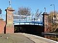
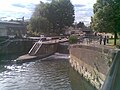
 Commercial Road Lock


History
edit-
 Grand Surrey Canal, 1806.
 -
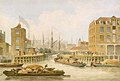 Regent's Canal Limehouse. 1823
 -
 Regents canal dock 1828.
 -
 Park Village East, Regent's Park, 1828
 -
 Macclesfield Bridge, Regent's Park, 1828
 -
 City Basin, Regent's Canal, 1828
 -
 Junction of the Regent's Canal at Paddington, 1828
 -
 The Double Lock and East Entrance to the Islington Tunnel, 1828
 -
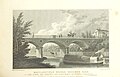
 Railway Bridge over the Regent's Canal, 1839
 -
 Grand Surrey Canal, 1852.
 -
 London Parks- Entertainment and Relaxation, 1943
 -
 Canal boat loaded with fruit pulp, 1944
 -
 Approaching Old Ford Lock No 8, Regent's Canal, East London, 1974
 -
 Sturt's Lock No 6, Regent's Canal, London, 1974
 -
 Roving bridge, Kingsland Basin, Regent's Canal, London, 1974


,_p269_(Canal_side).jpg)
,_p219.jpg)
,_p207.jpg)
,_p201.jpg)
,_p245.jpg)
_p017_-_Railway_Bridge_over_the_Regent%27s_Canal.jpg)


Regent's Canal elements
editBridges
edit-
 Blow-up Bridge
 -
 Number one bridge
 -


Locks
edit-
 Acton's Lock
 -
Camden Lock
-
 City Road Lock
 -
Commercial Road Lock
-
 Hawley Lock
 -
 Johnson's Lock
 -
 Kentish Town Lock
 -
 Limehouse Basin Lock
 -
 Mile End Lock
 -
 Old Ford Lock
 -
 Salmon Lane Lock
 -
 St Pancras Lock
 -
 Sturt's Lock


Tunnels
edit-
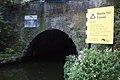
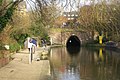 Islington tunnel
 -
 Lisson Grove tunnel
 -
 Maida Hill Tunnel


Basins
edit-
 Cumberland Basin
 -
 St Pancras Basin
 -
 Kingsland Basin
 -
 Wenlock Basin
 -
 City Road Basin
 -
 Battlebridge Basin
 -
 Limehouse Basin


See also
editFor more images, see also Category:Regent's Canal and it's subcategories.