Royal Wootton Bassett
town in Wiltshire, England, UK
English: Wootton Bassett is a small market town and civil parish located southwest of Swindon in northern Wiltshire, England. At the time of the United Kingdom Census 2001 its population was 11,043, indicating that the town has tripled in population total over the last 50 years.
Nederlands: Wootton Bassett is een civil parish in de unitary authority Wiltshire, in het Engelse graafschap Wiltshire. De civil parish telt
Polski: Wootton Bassett - miasto w Wielkiej Brytanii. w Anglii w hrabstwie Wiltshire, położone na północy hrabstwa, 10 km na zachód od Swindon i 18 km na południowy zachód od Malmesbury. Miasto zamieszkuje ponad 12 500 osób. Od czasów II wojny światowej miasto potroiło swoją populację. W poblizu miasta znajduje się duża jednostka RAF - Lyneham z lotniskiem (LYE/EGDL)
Română: Wootton Bassett este un oraş în comitatul Wiltshire, regiunea South West, Anglia. Oraşul se află în districtul North Wiltshire.
General views
edit-
 Western edge (Church Street allotments)
 -
 View from the south
 -
 View over St Bartholomew and All Saints Church
 -
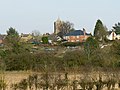
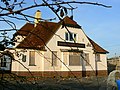
 View from The Barton


Roads and streets
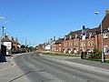
editHigh Street
edit-

-

-
 Town Hall
 -
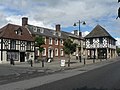 Town Hall
 -

-
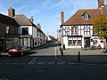 (looking down Wood St.)
 -
-

-

-

-

-


Other streets
edit-
 Church Street
 -


-
 Wood Street
 -


-
 Old Malmesbury Road

Roads
edit-
 Esso Station Coped Hall, near A3102 / B4042 roundabout
 -
 Coped Hall A3102 / B4042 roundabout
 -
 Woodshaw roundabout, Binknoll Lane
 -
 A3102 near Vastern
 -
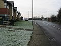 A3102 (High St. north)
 -
 Road near Harris Croft
 -
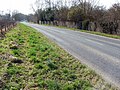 A3102 near Vastern


Buildings
editTown Hall, High Street
edit-
 Town Hall, High St.
 -


Post Office, High Street
edit-
 Post Office, High St.

Fire Station
edit-
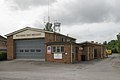 Fire Station
 -


Schools
edit-
 Wootton Bassett secondary school
 -
 Wootton Bassett infant school


Churches
edit-
 Wootton Bassett Methodist church, High St.
 -
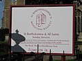
 St. Bartholomew and All Saints Church
 -

-


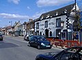
Pubs on the High Street
edit-
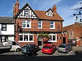
 The Angel, High St.

-
 Borough Arms, High St.
 -


-
 The Cross Keys, High St.
 -


-
 Red Lion, High St.
 -


-
 The Phoenix Bar, High St.
 -
 The Waggon and Horses, High St.
 -
 The Crown Hotel, High St.
 -
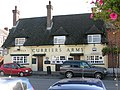 The Curriers Arms, High St.


Other pubs
edit-
 The Five Bells, Wood St.
 -


-
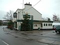
 Prince of Wales, B4042
 -

-


-
 The Old Nick (the former Police station), Station Road near High St
 -
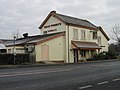
 The Town Local, Station Road / Nore Marsh Road
 -
 Sally Pussey's, A3102 to Swindon
 -
 Churchill House Restaurant, Swindon Road


-
 Beaufort Arms, Marlborough Road
 -

-

-

-

-


Former St Ives factory / Brewery housing development
edit-
 Former St Ivel factory site between Brynards Hill road and the rail line
 -
 Housing developments on the former St Ives site
 -
-

-

-

-

-
 The remains of the Beaufort Brewery, Station Road


Other housing
edit-
 Coped hall estate
 -
 New build in Ravens Walk


Other buildings
edit-
 Marsh Farm Hotel
 -
 Vastern Manor, Vastern


War Memorial & repatriations
edit-
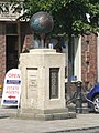 War Memorial, High St
 -


Rail transport
edit-
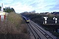
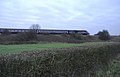 HST
HST -
 HST, Marlborough Road bridge
 -
 Cutting east of Marlborough Road bridge
 -
 Site of former Wootton Bassett station
 -

-
 Rail bridge over Whitehill Lane
 -
 reconstructed Wootton Bassett station at the Museum of the Great Western Railway (STEAM) in Swindon
 -
 Between A3102 bridge and Marlborough Road bridge
 -
 Skew bridge (A3102)
 -
 HST from Wales, Skew Bridge
 -
 Skew Bridge
 -
 File:Depot south of station site
 -
 Farm bridge near Brynard's Hill (west)
 -
 Footpath north of Wootton Bassett station site


Wilts & Berks Canal
edit-
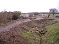 A spill weir under construction near Bincknoll Lane
 -

-

-

-
-


_-_geograph.org.uk_-_496684.jpg)
_-_geograph.org.uk_-_496686.jpg)


Scenery
editJubilee lake
edit-
 Jubilee Lake
 -

-

-


Mud Springs SSSI
edit_-_geograph.org.uk_-_496601.jpg)
_-_geograph.org.uk_-_496587.jpg)
_-_geograph.org.uk_-_496586.jpg)
_-_geograph.org.uk_-_496585.jpg)
_-_geograph.org.uk_-_496584.jpg)
_-_geograph.org.uk_-_496583.jpg)
Thunder Brook
edit-
 Thunder Brook
 -

-

-


