User:Kelvinc/Locator maps
I love the Rei-artur locator maps, but it turns out that the base map was missing Hawaii, which was a pretty big oversight for the United States map. Also, apparently the colour red was found to be "aggressive".[1] I found this curious, since the history of humankind suggests that depicting nation-states using "peaceful" or "calmer" colours would be just as big an NPOV violation. Nonetheless, this was the old colour scheme, so I whipped up some locator maps based on Image:BlankMap-World6.svg for the world's biggest countries, although steering clear of the People's Republic of China and India because the base map showed borders of actual control, which just seems to be asking for a lot of trouble if used for those two countries.
-
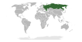 Russia
 -
 Canada
 -
 United States
 -
 Brazil
 -
 Australia


