Wallstraße (Ruhland)
| Object location | | View all coordinates using: OpenStreetMap |
|---|
vom Brauhausplatz zur Fischerstraße
edit-
 Wallstraße vom Brauhausplatz
 -
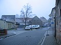
 vor Wallstraße 20
 -

-
-
-
 Wallstr. 1, Lindenplatzschule
links in Gutshof -

-


von der Fischerstraße zum Brauhausplatz
edit-
-
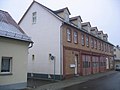
 rechts Wallstraße 4
 -
 Wallstr. 1, Lindenplatzschule
 -

-
-
-
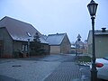
 am Brauhausplatz
links Brauhausplatz


