Category:1560s maps of Belgium
Countries of Europe: Albania · Belgium · Bosnia and Herzegovina · Croatia · Cyprus‡ · Denmark · France‡ · Germany · Greece · Hungary · Italy · Latvia · Lithuania · Netherlands‡ · Norway · Poland · Portugal‡ · Romania · Russia‡ · Serbia · Slovenia · Spain‡ · Sweden · Turkey‡ · Ukraine
‡: partly located in Europe
‡: partly located in Europe
Subcategories
This category has the following 2 subcategories, out of 2 total.
- 1560 maps of Belgium (1 F)
1
Media in category "1560s maps of Belgium"
The following 4 files are in this category, out of 4 total.
-
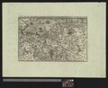
 Flandria, Brabantia et Holanda Nuova (FL35073033 2536645).jpg 6,480 × 4,850; 43.56 MB
-
 Guicciardini Map of Brabant.png 1,985 × 1,523; 5 MB
-
 UBBasel Map 1568 Kartenslg AA 61 Belgica et al.tiff 11,916 × 9,706, 2 pages; 330.92 MB
-

.jpg)

