Category:1590s maps of the Ottoman Empire
Subcategories
This category has the following 10 subcategories, out of 10 total.
'
- 1590s maps of Egypt (6 F)
- 1590s maps of Greece (2 F)
.
- 1590s maps of Bulgaria (1 F)
- 1590s maps of Cyprus (7 F)
- 1590s maps of Iraq (2 F)
- 1590s maps of Palestine (empty)
Media in category "1590s maps of the Ottoman Empire"
The following 3 files are in this category, out of 3 total.
-
 1590 Portolan chart of the Eastern Mediterranean, the Aegean and the Black Sea by Joan Oliva.tif 3,457 × 4,941; 48.89 MB
-
 Ca. 1592 map of the Ottoman Empire by Abraham Ortelius.jpg 12,561 × 9,755; 23.93 MB
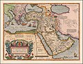
-
 Turcicum Imperium by Abraham Ortelius.jpg 3,287 × 2,540; 1.9 MB

