Category:Maps of the history of the Ottoman Empire in the 1590s
Maps of the history of the Ottoman Empire by decade: ◀ · 1500s · 1510s · 1520s · 1530s · 1540s · 1550s · 1560s · 1570s · 1580s · 1590s · ▶
Media in category "Maps of the history of the Ottoman Empire in the 1590s"
The following 14 files are in this category, out of 14 total.
-
 00-Ottoman Empire map 1590-00.png 1,070 × 720; 246 KB
-
 Ottoman 1590 (orthographic projection).png 2,000 × 2,000; 639 KB
-
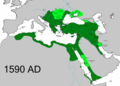
 Ottoman 1590.png 1,012 × 846; 34 KB
-
 Ottoman Empire Detailed.png 3,711 × 3,224; 5.44 MB
-
 Banatski ustanak-sr.png 918 × 784; 73 KB
-
 Banatski ustanak.gif 1,209 × 691; 1.63 MB
-
 Banatski ustanak.png 918 × 784; 71 KB
-
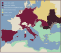 Map of the Holy League in 1595.svg 1,140 × 990; 525 KB
-
 Osmanlı Devleti Ulaşmış Olduğu En Geniş Sınırları 1595 Yılında.png 2,445 × 2,015; 1.11 MB
-
 Osmanlı haritası 3.murad 1592.jpg 4,476 × 2,763; 7.57 MB
-
 Ottoman empire largest borders map.png 700 × 800; 156 KB
-
 Ottoman-Empire-map-1590-peak.jpg 1,079 × 720; 89 KB
-
 OttomanEmpire1590 with labels.svg 3,596 × 2,582; 711 KB
-
 OttomanEmpire1590.png 3,596 × 2,581; 1.21 MB

.png)


