Category:1600s maps of Switzerland
Countries of Europe: Albania · Belgium · Bosnia and Herzegovina · Croatia · Cyprus‡ · Denmark · France‡ · Georgia‡ · Germany · Greece · Republic of Ireland · Italy · Lithuania · Netherlands‡ · Norway · Portugal‡ · Romania · Russia‡ · Serbia · Spain‡ · Switzerland · Turkey‡ · Ukraine
‡: partly located in Europe
‡: partly located in Europe
Subcategories
This category has only the following subcategory.
M
Media in category "1600s maps of Switzerland"
The following 12 files are in this category, out of 12 total.
-
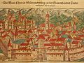 Chur, Switzerland (1600) center.jpg 800 × 600; 154 KB
-
 Chur, Switzerland (1600)- left.jpg 800 × 600; 158 KB
-
 Genf, Switzerland (1600) center.jpg 800 × 600; 154 KB
-
 Map of Switzerland (1600) north east.jpg 800 × 600; 165 KB
-
 Map of Switzerland (1600) north west.jpg 800 × 600; 171 KB
-
 Map of Switzerland (1600) south west.jpg 800 × 600; 152 KB
-
 Map of Switzerland (1600).jpg 800 × 600; 137 KB
-
 Map of Wallisserland, Switzerland (1600) a detail.jpg 800 × 1,067; 264 KB
-
 Map of Wallisserland, Switzerland (1600).jpg 800 × 1,067; 167 KB
-
 Map of Western Switzerland (1600) a closer view.jpg 637 × 593; 142 KB
-
 Map of Western Switzerland (1600).jpg 800 × 1,067; 167 KB
-
 UBBasel Map 1600-1610 Kartenslg Schw A 72 Helvetia.tiff 5,340 × 4,053, 2 pages; 61.95 MB
_center.jpg)
-_left.jpg)
_center.jpg)
_north_east.jpg)
_north_west.jpg)
_south_west.jpg)
.jpg)
_a_detail.jpg)
.jpg)
_a_closer_view.jpg)
.jpg)