Category:1600s maps of Ukraine
Countries of Europe: Albania · Belgium · Bosnia and Herzegovina · Croatia · Cyprus‡ · Denmark · France‡ · Georgia‡ · Germany · Greece · Republic of Ireland · Italy · Lithuania · Netherlands‡ · Norway · Portugal‡ · Romania · Russia‡ · Serbia · Spain‡ · Switzerland · Turkey‡ · Ukraine
‡: partly located in Europe
‡: partly located in Europe
Subcategories
This category has the following 4 subcategories, out of 4 total.
- 1600 maps of Ukraine (empty)
- 1601 maps of Ukraine (1 F)
- 1606 maps of Ukraine (empty)
- 1608 maps of Ukraine (empty)
Media in category "1600s maps of Ukraine"
The following 2 files are in this category, out of 2 total.
-

-
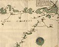 Crop focusing on the Kiev Voivodeship in the Prototype of the "special" map of Ukraine.jpg 6,067 × 4,857; 1.65 MB
.jpg)
