Category:1620s maps of the Americas
Subcategories
This category has the following 2 subcategories, out of 2 total.
N
S
Media in category "1620s maps of the Americas"
The following 15 files are in this category, out of 15 total.
-
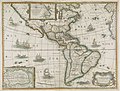
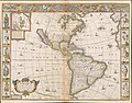
 1621 Americæ Blaeu.jpg 6,689 × 4,969; 36.6 MB
-
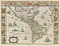
 America, noviter delineata LOC 83691963.jpg 6,651 × 5,519; 7.53 MB
-
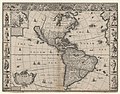
 America, noviter delineata LOC 83691963.tif 6,651 × 5,519; 105.02 MB
-
 1627 Amerique Bertius.jpg 3,657 × 2,784; 4.6 MB
-
 1628MapAmericas.JPG 3,872 × 2,592; 2.49 MB
-
 Los mapas de Willien Janszon Blaeu.jpg 2,000 × 1,522; 670 KB
-

-

-
-

-

-
 Description de las Yndias Ocidentalis.jpg 1,409 × 1,006; 995 KB
-
 Map of Meridian Line set under the Treaty of Tordesillas.jpg 990 × 709; 141 KB
-
 Terra Firma et Novum regnum Granatense et Popayan - btv1b55004702m.jpg 7,677 × 5,992; 4.89 MB
-
 Speed-Goos America 1626 (1676) UTA.jpg 1,448 × 1,139; 1.28 MB


.jpg)
.jpg)


_UTA.jpg)