Category:1690s maps of Lithuania
Countries of Europe: Armenia‡ · Austria · Azerbaijan‡ · Belarus · Belgium · Bulgaria · Cyprus‡ · Denmark · France‡ · Georgia‡ · Germany · Greece · Hungary · Republic of Ireland · Italy · Lithuania · Montenegro · Netherlands‡ · Norway · Poland · Portugal‡ · Russia‡ · Spain‡ · Sweden · Switzerland · Turkey‡ · Ukraine
‡: partly located in Europe
‡: partly located in Europe
Subcategories
This category has the following 2 subcategories, out of 2 total.
- 1692 maps of Lithuania (2 F)
*
Media in category "1690s maps of Lithuania"
The following 8 files are in this category, out of 8 total.
-

-

-
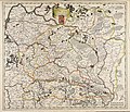
 Estats De La Couronne De Pologne.jpg 1,593 × 1,300; 3.07 MB
-
-
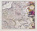 Poland and Lit.jpg 7,600 × 6,400; 79.72 MB
-

-
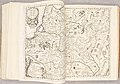 Atlante Veneto Volume 2 100.jpg 10,592 × 7,412; 7.98 MB
-
 Atlas Van der Hagen-KW1049B10 037-Tabula PRUSSIAE EXIMIA CURA CONSCRIPTA.jpeg 5,500 × 4,627; 4.39 MB
_from_atlas_Isolare_Descrttione_by_Vincenzo_Maria_Coronelli,_published_in_Venice_in_1690.jpg)


