Category:1680s maps of Lithuania
Countries of Europe: Armenia‡ · Austria · Azerbaijan‡ · Belgium · Bosnia and Herzegovina · Bulgaria · Croatia · Cyprus‡ · Denmark · France‡ · Georgia‡ · Germany · Greece · Hungary · Republic of Ireland · Italy · Lithuania · Montenegro · Netherlands‡ · Norway · Poland · Portugal‡ · Romania · Russia‡ · Serbia · Slovakia · Slovenia · Spain‡ · Sweden · Switzerland · Turkey‡ · Ukraine
‡: partly located in Europe
‡: partly located in Europe
Subcategories
This category has only the following subcategory.
Media in category "1680s maps of Lithuania"
The following 3 files are in this category, out of 3 total.
-
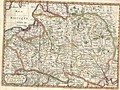 XSanson1683.jpg 1,387 × 1,038; 892 KB
-
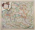 Polen, Litouwen (full margins v2)- Danckerts, 1684.jpg 2,870 × 2,456; 1.46 MB
-
 Magnus Ducat Lithuaniae and Rus Alba(Belarus).jpg 4,087 × 2,012; 4.66 MB

-_Danckerts,_1684.jpg)
.jpg)