Category:1680s maps of Denmark
Countries of Europe: Armenia‡ · Austria · Azerbaijan‡ · Belgium · Bosnia and Herzegovina · Bulgaria · Croatia · Cyprus‡ · Denmark · France‡ · Georgia‡ · Germany · Greece · Hungary · Republic of Ireland · Italy · Lithuania · Montenegro · Netherlands‡ · Norway · Poland · Portugal‡ · Romania · Russia‡ · Serbia · Slovakia · Slovenia · Spain‡ · Sweden · Switzerland · Turkey‡ · Ukraine
‡: partly located in Europe
‡: partly located in Europe
Media in category "1680s maps of Denmark"
The following 7 files are in this category, out of 7 total.
-
-

-

-

-
 Danemark vizt Jutland, Zeland, Sleswick, Holstein (NYPL b14428893-1503430).jpg 5,248 × 6,299; 6.97 MB
-
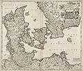
 Map of Denmark, 1683.jpg 718 × 1,036; 164 KB
-
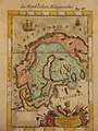 Map of Norway, etc., c.1700.jpg 800 × 1,067; 215 KB
.jpg)
.jpg)
.jpg)
.jpg)
.jpg)

