Category:1680s maps of Cyprus
Countries of Europe: Armenia‡ · Austria · Azerbaijan‡ · Belgium · Bosnia and Herzegovina · Bulgaria · Croatia · Cyprus‡ · Denmark · France‡ · Georgia‡ · Germany · Greece · Hungary · Republic of Ireland · Italy · Lithuania · Montenegro · Netherlands‡ · Norway · Poland · Portugal‡ · Romania · Russia‡ · Serbia · Slovakia · Slovenia · Spain‡ · Sweden · Switzerland · Turkey‡ · Ukraine
‡: partly located in Europe
‡: partly located in Europe
Media in category "1680s maps of Cyprus"
The following 7 files are in this category, out of 7 total.
-
 1680 Sidon detail map Turcicum imperium by Frederik de Wit BPL 15917.png 1,064 × 748; 1.55 MB
-

-
-
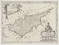
 Cipro - Piacenza Francesco - 1688.jpg 1,779 × 1,500; 1.76 MB
-
 Cyprus Insula - Dapper Olfert - 1688.jpg 800 × 632; 289 KB
-
 Map of Cyprus, 1685.jpg 635 × 900; 419 KB
-
 Map of Cyprus, Description de L'Universe (Alain Manesson Mallet, 1683).jpg 725 × 1,078; 163 KB

.jpg)


.jpg)