Category:1700s maps of Peru
Media in category "1700s maps of Peru"
The following 14 files are in this category, out of 14 total.
-

-

-

-
 Peru and the Amazones, country. (Inset- the Gallapagos Islands.) (NYPL b15373374-1505156).tiff 4,472 × 6,299; 80.61 MB
-

-

-

-

-
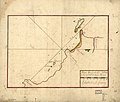
 Plan du port de Pisco par la latt. de 13 g. 40. m. sud. LOC 90682913.jpg 5,579 × 4,787; 2.92 MB
-
 Plan du port de Pisco par la latt. de 13 g. 40. m. sud. LOC 90682913.tif 5,579 × 4,787; 76.41 MB
-
 Plan du port du Callao par les 12. d. de latt. sud suiuant le compas. LOC 90682871.jpg 5,545 × 4,736; 3.88 MB
-
 Plan du port du Callao par les 12. d. de latt. sud suiuant le compas. LOC 90682871.tif 5,545 × 4,736; 75.13 MB
-
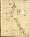 Plano q. contiene desde el puerto d. Guayaquil a el d. Lima, sacado a Luz LOC 90682858.jpg 5,494 × 7,008; 4.79 MB
-
 Plano q. contiene desde el puerto d. Guayaquil a el d. Lima, sacado a Luz LOC 90682858.tif 5,494 × 7,008; 110.16 MB
.jpg)

_(NYPL_b15373374-1505156).jpg)


