Category:1720s maps of Egypt
Countries of Asia: Armenia‡ · Azerbaijan‡ · People's Republic of China · Cyprus‡ · Egypt‡ · Georgia‡ · India · Indonesia‡ · Iran · Iraq · Japan · Philippines · Russia‡ · Syria · Turkey‡
Limited recognition: Abkhazia‡ · Taiwan · State of Palestine
‡: partly located in Asia
Limited recognition: Abkhazia‡ · Taiwan · State of Palestine
‡: partly located in Asia
Subcategories
This category has only the following subcategory.
Media in category "1720s maps of Egypt"
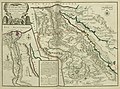
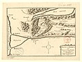
The following 17 files are in this category, out of 17 total.
-
 Van der Aa De Stadt Alexandrie 1720 UTA.jpg 8,818 × 6,840; 17.3 MB
-

-
 Aegyptus hodierna - a Iohanne Baptista Homann - btv1b85951740.jpg 8,011 × 10,384; 16.28 MB
-

-
 Aegyptus Hodierna, Map of Egypt MET L.2009.33.13.jpg 1,736 × 1,940; 3.2 MB
-

-

-

-

-

-
 Egypt and Barca etc. - DPLA - 659a1b36bcade6cd7a698fb6ffe7c1cd.jpg 1,000 × 477; 156 KB
-
 Egyptus Hodierna - DPLA - d7942ff4dfb2e452e4b91781f3d985e9.jpg 836 × 1,000; 296 KB
-
-
 Map - Special Collections University of Amsterdam - OTM- HB-KZL 33.21.25.tif 7,648 × 6,693; 146.45 MB
-
 Map of Turkey, Persia, Mecran (Balochistan).jpg 1,756 × 1,480; 899 KB
-

-


.jpg)
.jpg)


.jpg)

