Category:1740s maps of Egypt
Countries of Asia: Afghanistan · Armenia‡ · Azerbaijan‡ · People's Republic of China · Cyprus‡ · Egypt‡ · Georgia‡ · India · Indonesia‡ · Iran · Iraq · Japan · Pakistan · Philippines · Russia‡ · Syria · Turkey‡
Limited recognition: Abkhazia‡ · Taiwan · State of Palestine
‡: partly located in Asia
Limited recognition: Abkhazia‡ · Taiwan · State of Palestine
‡: partly located in Asia
Media in category "1740s maps of Egypt"
The following 13 files are in this category, out of 13 total.
-

-
-

-
 Aegypti ac nobilissimi ejus fluminis... - btv1b53119516w.jpg 6,992 × 8,300; 9.56 MB
-
 Carte des Voyages de Télémaque (Cropped).tif 3,030 × 1,685; 24.84 MB
-
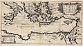 Carte des Voyages de Télémaque.jpg 3,030 × 1,688; 3.79 MB
-
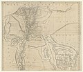
 Map - Special Collections University of Amsterdam - OTM- HB-KZL 33.21.11.tif 7,536 × 6,367; 137.28 MB
-
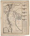
 Map - Special Collections University of Amsterdam - OTM- HB-KZL 33.21.18.tif 6,431 × 7,908; 145.5 MB
-
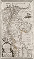
 Ottoman Egypt and Nubia, 1749.png 885 × 1,029; 1.82 MB
-
-

-
 Safavid Persian Empire.jpg 1,195 × 969; 370 KB
-
 Égypte, cours du Nil - R.P. - btv1b8595176t.jpg 3,848 × 6,456; 5.01 MB


.jpg)
.jpg)

