Category:1730s maps of Greece
Countries of Europe: Armenia‡ · Azerbaijan‡ · Belgium · Bosnia and Herzegovina · Bulgaria · Croatia · Cyprus‡ · Denmark · France‡ · Georgia‡ · Germany · Greece · Hungary · Republic of Ireland · Italy · Lithuania · Netherlands‡ · Norway · Poland · Portugal‡ · Russia‡ · Serbia · Slovenia · Spain‡ · Sweden · Switzerland · Turkey‡ · Ukraine · United Kingdom
Limited recognition: Abkhazia‡
‡: partly located in Europe
Limited recognition: Abkhazia‡
‡: partly located in Europe
Subcategories
This category has only the following subcategory.
Media in category "1730s maps of Greece"
The following 5 files are in this category, out of 5 total.
-
 1730 map of the Aegean Sea by Guillaume de L'Isle.tif 7,058 × 5,971; 241.17 MB
-
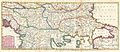
 A general map of Turkey in Europe, Hungary, 1736.jpg 915 × 734; 295 KB
-
-
 Ca. 1730 map of the Northwestern Aegean Sea by Johannes van Keulen.jpg 4,898 × 4,176; 3.94 MB
-
 Mercator's Orbis Antiqui Tabulae Geographicae Secundum Cl. Ptolemaeum (1730) 33.jpg 6,568 × 5,231; 5.44 MB

_-_Geographicus_-_Balkans-lafeuille-1738.jpg)

_33.jpg)