Category:1730s maps of the Netherlands
Countries of Europe: Armenia‡ · Azerbaijan‡ · Belgium · Bosnia and Herzegovina · Bulgaria · Croatia · Cyprus‡ · Denmark · France‡ · Georgia‡ · Germany · Greece · Hungary · Republic of Ireland · Italy · Lithuania · Netherlands‡ · Norway · Poland · Portugal‡ · Russia‡ · Serbia · Slovenia · Spain‡ · Sweden · Switzerland · Turkey‡ · Ukraine · United Kingdom
Limited recognition: Abkhazia‡
‡: partly located in Europe
Limited recognition: Abkhazia‡
‡: partly located in Europe
Provinces of the Netherlands:
Subcategories
This category has the following 2 subcategories, out of 2 total.
Media in category "1730s maps of the Netherlands"
The following 7 files are in this category, out of 7 total.
-
 Map - Special Collections University of Amsterdam - OTM- HB-KZL I 2 A 6 (08).jpg 11,154 × 7,428; 31.2 MB
-
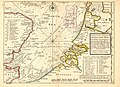
 A new and exact map of the United Provinces, or Netherlands &c (NYPL b15369994-1630448).jpg 6,954 × 4,307; 9.36 MB
-
 Part of ye Sea Coast of England Holland & Flanders Atlas Minor 1736.jpg 3,284 × 2,390; 1.4 MB
-
 Géographie Buffier-Carte des Pays-Bas.jpg 7,600 × 9,568; 6.45 MB
-
 Les Provinces des Pays-Bas Catholique(s) - btv1b52506994b (1 of 2).jpg 10,931 × 8,230; 17.77 MB
-

-
 Merwede map.png 4,000 × 1,774; 13.8 MB
.jpg)
.jpg)


_-_btv1b52506994b_(1_of_2).jpg)
.jpg)
