Category:1750s maps of Canada
Subcategories
This category has the following 13 subcategories, out of 13 total.
- 1750 maps of Canada (15 F)
- 1753 maps of Canada (2 F)
- 1756 maps of Canada (3 F)
N
- 1750s maps of Nova Scotia (5 F)
O
Q
Media in category "1750s maps of Canada"
The following 5 files are in this category, out of 5 total.
-

-
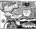
 Carte de la frontière canadienne vers 1755.jpg 3,612 × 2,874; 1.05 MB
-

-
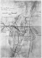
 Halifaxmap1750.jpg 696 × 579; 200 KB
-
 Historic highways of America (Volume 12) - II.png 2,066 × 2,800; 4.61 MB

._Atlas_Moreau_de_Saint_M%C3%A9ry._-_btv1b10104592t.jpg)

_-_II.png)