Category:1755 maps of North America
Temperate regions: North America · South America · Africa · Europe · – Polar regions: – Other regions:
English: 1755 maps of North America
Subcategories
This category has the following 4 subcategories, out of 4 total.
Media in category "1755 maps of North America"
The following 76 files are in this category, out of 76 total.
-
 1755 Bellin Map of the Great Lakes - Geographicus - GreatLakes-bellin-1755.jpg 4,000 × 3,215; 3.49 MB
-

-
 A history of the American nation (1919) (14780060384).jpg 2,944 × 1,818; 628 KB
-
 A map of the British & French plantations in North America. LOC 2017585922.jpg 3,348 × 2,885; 1.64 MB
-
 A map of the British & French plantations in North America. LOC 2017585922.tif 3,348 × 2,885; 27.63 MB
-
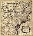
 A map of the British and French settlements in North America LOC 2003623385.jpg 6,041 × 4,965; 5.4 MB
-
 A map of the British and French settlements in North America LOC 2003623385.tif 6,041 × 4,965; 85.81 MB
-
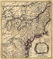
 A map of the British and French settlements in North America LOC 2009582533.jpg 6,792 × 4,818; 4.84 MB
-
 A map of the British and French settlements in North America LOC 2009582533.tif 6,792 × 4,818; 93.62 MB
-
 A map of the British and French settlements in North America. LOC 73694933.jpg 4,667 × 3,350; 2.58 MB
-
 A map of the British and French settlements in North America. LOC 73694933.tif 4,667 × 3,350; 44.73 MB
-
 A Map of the British and French settlements in North America. LOC 77690484.jpg 4,694 × 3,556; 2.57 MB
-
 A Map of the British and French settlements in North America. LOC 77690484.tif 4,694 × 3,556; 47.76 MB
-
 A Map of the British and French settlements in North America. NYPL434069.tiff 4,698 × 3,944; 41.68 MB
-

-
-
-

-
-

-

-
-
 A new map of Jamaica - btv1b5970658v.jpg 15,700 × 9,867; 22.77 MB
-

-
-

-
-
-

-
-
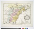
 An old map of North America - 1755 palairet.jpg 1,598 × 1,265; 411 KB
-
 Carte de l'Amérique septentrionale, 1754. LOC 73695115.jpg 6,936 × 5,700; 6 MB
-
 Carte de l'Amérique septentrionale, 1754. LOC 73695115.tif 6,936 × 5,700; 113.11 MB
-
 Carte de l'Amérique septentrionale, 1755. NYPL434525.tiff 5,155 × 4,408; 34.21 MB
-
-

-

-
-

-

-
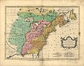
 EvansPownallMap1755.jpg 2,048 × 1,535; 1.77 MB
-
 Mitchell-LeRouge Amerique Meridionale 1755 (1756) UTA.JPG 885 × 605; 119 KB
-
 Lopez & Cruz Cano Mapa Maritima del Golfo de Mexico e Islas de la America 1755 UTA (left).jpg 5,182 × 7,046; 18.14 MB
-
-
 Map of the country about the Mississippi. LOC 74695023.jpg 7,331 × 4,341; 3.58 MB
-
 Map of the country about the Mississippi. LOC 74695023.tif 7,331 × 4,341; 91.05 MB
-

-

-
-

-
-

-
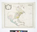
 North America. LOC 73696680.jpg 6,264 × 5,614; 6.37 MB
-
 North America. LOC 73696680.tif 6,264 × 5,614; 100.61 MB
-

-

-

-
 Canada, Louisiane et terres angloises (NYPL b13868924-1261393).jpg 11,329 × 6,881; 13.09 MB
-
 Canada, Louisiane et terres angloises (NYPL b13868924-1261071).jpg 7,668 × 5,927; 11.45 MB
-
 Canada, Louisiane et terres angloises (NYPL b13868924-1268389).jpg 7,561 × 5,867; 10.43 MB
-
 Canada, Louisiane et terres angloises (NYPL b13868924-484207).jpg 7,086 × 5,330; 7.02 MB
-

-

-
-

-
-

-
-

-
 Carte de l'Amérique septentrionale, 1755 (NYPL b15307731-434525).tiff 5,155 × 4,408; 65.02 MB
-
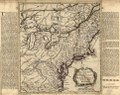
 A map of the British and French settlements in North America (NYPL b15379438-434853).jpg 5,408 × 4,160; 4.94 MB
-
 Partie occidentale de la Nouvelle France ou du Canada LOC 73694802.jpg 6,798 × 5,312; 5.52 MB
-
 Partie occidentale de la Nouvelle France ou du Canada LOC 73694802.tif 6,798 × 5,312; 103.31 MB
-
 Theatrum belli in America Septentrionali. LOC 73696824.jpg 9,905 × 7,312; 13.9 MB
-
 Theatrum belli in America Septentrionali. LOC 73696824.tif 9,905 × 7,312; 207.21 MB
-
 Westerncanada.jpg 2,520 × 2,115; 1.48 MB


_(14780060384).jpg)


.jpg)

_UTA.JPG)
.jpg)
.jpg)


.jpg)

.jpg)

.jpg)
.jpg)
.jpg)
.jpg)
.jpg)
.jpg)
.jpg)
.jpg)
.jpg)
.jpg)
.jpg)


