Category:1757 maps of North America
Temperate regions: North America · South America · Africa · Europe · Asia · – Polar regions: – Other regions:
English: 1757 maps of North America
Subcategories
This category has the following 2 subcategories, out of 2 total.
C
U
Media in category "1757 maps of North America"
The following 29 files are in this category, out of 29 total.
-

-
 A map of Maryland with the Delaware counties and the southern part of New Jersey.tif 3,343 × 2,343, 7 pages; 20.27 MB
-

-
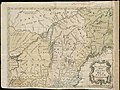 A new and accurate map of the present war in North America (4231162161).jpg 2,000 × 1,506; 3 MB
-

-

-

-

-

-

-

-

-
-

-
-
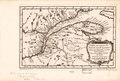
 L'Amérique septentrionale, LOC 74694146.jpg 7,324 × 6,041; 7.53 MB
-
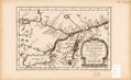
 L'Amérique septentrionale, LOC 74694147.jpg 7,406 × 5,675; 7.1 MB
-
 L'Amérique septentrionale, LOC 74694147.tif 7,406 × 5,675; 120.25 MB
-
 L'Amérique septentrionale, LOC 74695304.jpg 7,366 × 5,648; 7.12 MB
-
 L'Amérique septentrionale, LOC 74695304.tif 7,366 × 5,648; 119.03 MB
-
 L'Amérique septentrionale, LOC 75691627.jpg 7,459 × 5,846; 7.3 MB
-
 L'Amérique septentrionale, LOC 75691627.tif 7,459 × 5,846; 124.76 MB
-

-
 L'Amérique septentrionale (NYPL b15307708-483727).tiff 5,059 × 4,288; 62.07 MB
-
 L'Amérique septentrionale (NYPL b15307708-434521).tiff 5,587 × 4,856; 77.63 MB
-
 A new and accurate map of the present war in North America (NYPL b20643833-5403998).jpg 8,398 × 6,658; 51.9 MB
-
 A new and accurate map of the present war in North America (NYPL b20643833-5403998).tiff 10,328 × 7,760, 2 pages; 229.57 MB
-

-
 Ευρωπαϊκός Αποικισμός της Αμερικής.jpg 750 × 575; 109 KB

.jpg)


.jpg)
.jpg)
