Category:1781 maps of the United States
Countries of the Americas: Canada · United States of America
States of the United States: California · Massachusetts · New Hampshire · New Jersey · New York · Virginia
Subcategories
This category has the following 6 subcategories, out of 6 total.
C
- 1781 maps of California (2 F)
M
- 1781 maps of Massachusetts (7 F)
N
- 1781 maps of New Hampshire (2 F)
- 1781 maps of New Jersey (19 F)
V
- 1781 maps of Virginia (3 F)
Media in category "1781 maps of the United States"
The following 7 files are in this category, out of 7 total.
-
 1781 Newport Rhode Island detail of map byDelamarche BPL 12306.png 1,221 × 608; 1.07 MB
-
 A new and accurate map of Quebec and its boundaries from a late survey. LOC 2017593666.jpg 5,470 × 5,197; 3.04 MB
-
 After Victory, Cowpens National Battlefield, South Carolina (5810491415).jpg 4,000 × 3,000; 2.78 MB
-

-

-
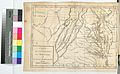 Carte de la Virginie, du Maryland et de l'etat de Delaware (NYPL b15346082-433630).jpg 4,367 × 2,682; 2.35 MB
-
 The thirteen United Colonies 1781.jpg 1,814 × 1,278; 1.67 MB


.jpg)
.jpg)
.jpg)
.jpg)
