Category:1783 maps of the United States
Media in category "1783 maps of the United States"
The following 37 files are in this category, out of 37 total.
-
 A general map of North America - from the latest observations - J. Lodge sculp. NYPL433898.tiff 3,686 × 3,742; 39.47 MB
-
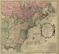
 A map of the United States of America agreeable to the peace of 1783. LOC 74696218.jpg 5,260 × 4,740; 3.97 MB
-
 A map of the United States of America agreeable to the peace of 1783. LOC 74696218.tif 5,260 × 4,740; 71.33 MB
-
 A map of the United States of America, as settled by the peace of 1783. LOC 00552212.jpg 3,000 × 2,484; 1.31 MB
-
 A map of the United States of America, as settled by the peace of 1783. LOC 00552212.tif 3,000 × 2,484; 21.32 MB
-
 A map of the United States of America, as settled by the peace of 1783. NYPL434886.tiff 3,703 × 3,696; 39.19 MB
-
 A map of the United States of America, as settled by the peace of 1783. NYPL483736.tiff 3,879 × 3,792; 42.12 MB
-

-

-
 An accurate map of the United States of America... (2674712300).jpg 2,000 × 1,733; 3.42 MB
-

-
-
 Carte de la Louisiane et de la Floride. LOC 73691856.jpg 3,714 × 5,654; 2.96 MB
-
 Carte de la Louisiane et de la Floride. LOC 74692215.jpg 3,709 × 6,018; 3.02 MB
-
 Carte de la Louisiane, et de la Floride. LOC 74692214.jpg 4,187 × 5,819; 3.55 MB
-
 Carte de la partie nord, des États Unis de l'Amérique septentrionale. LOC 74692115.jpg 4,136 × 2,831; 2.04 MB
-
 Carte de la partie nord, des États Unis de l'Amérique septentrionale. LOC 74692115.tif 4,136 × 2,831; 33.5 MB
-
 Carte de la partie nord, des États Unis de l'Amérique septentrionale. LOC 74692116.jpg 4,460 × 3,009; 2.34 MB
-
 Carte de la partie nord, des États Unis de l'Amérique septentrionale. LOC 74692116.tif 4,460 × 3,009; 38.4 MB
-
 Carte de la partie sud des Etats Unis de l'Amérique septentrionale. LOC 73691853.jpg 5,141 × 3,074; 2.51 MB
-
 Carte de la partie sud des Etats Unis de l'Amérique septentrionale. LOC 73691853.tif 5,141 × 3,074; 45.21 MB
-
 Carte de la partie sud des Etats Unis de l'Amérique septentrionale. LOC 73691854.jpg 4,182 × 2,841; 1.98 MB
-
 Carte de la partie sud des Etats Unis de l'Amérique septentrionale. LOC 73691854.tif 4,182 × 2,841; 33.99 MB
-
 Carte des Etats-Unis de l'Amerique suivant le Traité de Paix de 1783. LOC 73691628.jpg 9,247 × 6,915; 11.06 MB
-
 Carte des Etats-Unis de l'Amerique suivant le Traité de Paix de 1783. LOC 73691628.tif 9,247 × 6,915; 182.94 MB
-

-
 Carte du Canada qui comprend la partie septentrionale des Etats Unis d'Amérique. LOC 73695761.tif 7,926 × 6,086; 138.01 MB
-

-

-

-

-

-
 Partie méridionale des possessions angloises en Amérique. LOC 73691857.jpg 4,122 × 2,875; 2.12 MB
-
 Partie méridionale des possessions angloises en Amérique. LOC 73691857.tif 4,122 × 2,875; 33.91 MB
-
 Plano de la ciudad y puerto de San Agustin de la Florida. LOC 73694479.tif 4,488 × 2,347; 30.14 MB
-

-


.jpg)


