Category:1800s maps of Africa
Temperate regions: North America · South America · Africa · Europe · Asia · Oceania – Polar regions: – Other regions:
Subcategories
This category has the following 15 subcategories, out of 15 total.
- 1802 maps of Africa (20 F)
- 1803 maps of Africa (3 F)
- 1804 maps of Africa (5 F)
- 1805 maps of Africa (8 F)
- 1807 maps of Africa (4 F)
- 1808 maps of Africa (8 F)
A
- 1800s maps of Algeria (2 F)
E
- 1800s maps of Ethiopia (5 F)
L
M
- 1800s maps of Morocco (1 F)
Media in category "1800s maps of Africa"
The following 11 files are in this category, out of 11 total.
-

-
 Africa (Grosso Collection).jpg 4,596 × 3,204; 11.09 MB
-
 Cape of Good Hope.png 3,637 × 4,194; 23.35 MB
-
 Chart of Amphila Bay (plate 10).jpg 1,327 × 966; 158 KB
-
 Chart of Amphila Bay (plate 10, page 146).jpg 6,758 × 4,914; 2.26 MB
-
 Chart of the harbour of Massowa (Plate 14).jpg 909 × 1,267; 157 KB
-
 Chart of the harbour of Mosambique (plate 5).jpg 929 × 1,316; 202 KB
-
 Chart of the harbour of Mosambique (plate 5, page 25).jpg 2,569 × 3,694; 1.13 MB
-
 General chart of the East Coast of Africa (Plate 2).jpg 1,047 × 1,489; 234 KB
-
 General chart of the East Coast of Africa (Plate 2, page 12).jpg 4,830 × 6,908; 3.11 MB
-
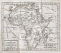 Meletius II of Athens Geographia vol4 Venice 1807 Africa.jpg 3,725 × 3,240; 2.7 MB
.jpg)
.jpg)

.jpg)
.jpg)
.jpg)
.jpg)
.jpg)
.jpg)
.jpg)
