Category:1810s maps of Hungary
Countries of Europe: Albania · Armenia‡ · Austria · Azerbaijan‡ · Belgium · Bosnia and Herzegovina · Bulgaria · Croatia · Cyprus‡ · Czech Republic · Denmark · Finland · France‡ · Georgia‡ · Germany · Greece · Hungary · Republic of Ireland · Italy · Lithuania · Netherlands‡ · Norway · Poland · Portugal‡ · Romania · Russia‡ · Slovakia · Slovenia · Spain‡ · Sweden · Turkey‡ · Ukraine · United Kingdom
Limited recognition: Abkhazia‡
‡: partly located in Europe
Limited recognition: Abkhazia‡
‡: partly located in Europe
Media in category "1810s maps of Hungary"
The following 5 files are in this category, out of 5 total.
-
-
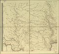 Подробная карта Российской империи и близлежащих заграничных владений — лист 009.jpg 4,887 × 4,485; 10.9 MB
-
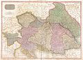 1818 Pinkerton Map of the Austrian Empire - Geographicus - Austria-pinkerton-1818.jpg 5,000 × 3,642; 5.51 MB
-
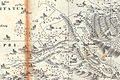 Foldrengesterkep 1810.jpg 470 × 314; 212 KB
-
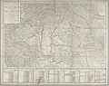
 Hungary 1817.jpg 5,048 × 4,080; 2.42 MB


