Category:1860s maps of Hungary
Countries of Europe: Albania · Armenia‡ · Austria · Azerbaijan‡ · Belarus · Belgium · Bosnia and Herzegovina · Bulgaria · Croatia · Cyprus‡ · Czech Republic · Denmark · Estonia · Finland · France‡ · Georgia‡ · Germany · Greece · Hungary · Republic of Ireland · Italy · Latvia · Lithuania · Moldova · Montenegro · Netherlands‡ · Norway · Poland · Portugal‡ · Romania · Russia‡ · Serbia · Slovenia · Spain‡ · Sweden · Switzerland · Turkey‡ · Ukraine · United Kingdom
Limited recognition: Abkhazia‡
‡: partly located in Europe
Limited recognition: Abkhazia‡
‡: partly located in Europe
Media in category "1860s maps of Hungary"
The following 5 files are in this category, out of 5 total.
-
 1862 Stieler Map of Poland and Hungary - Geographicus - Polen-perthes-1862.jpg 2,844 × 2,551; 1.97 MB
-
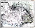 Hungary, Galicia and Transylvania.jpg 3,000 × 2,354; 2.48 MB
-
 Hetény and its surroundings at the middle of the 19th century.png 3,658 × 2,842; 21.66 MB
-
 Lucfalva kataszteri térképe és a környék helységnevei.png 1,293 × 637; 1.32 MB
-
 Map of Szolnok on the middle of the 19th century.jpg 7,578 × 5,777; 8.37 MB


