Category:1860s maps of Montenegro
Countries of Europe: Albania · Armenia‡ · Austria · Azerbaijan‡ · Belarus · Belgium · Bosnia and Herzegovina · Bulgaria · Croatia · Cyprus‡ · Czech Republic · Denmark · Estonia · Finland · France‡ · Georgia‡ · Germany · Greece · Hungary · Republic of Ireland · Italy · Latvia · Lithuania · Moldova · Montenegro · Netherlands‡ · Norway · Poland · Portugal‡ · Romania · Russia‡ · Serbia · Slovenia · Spain‡ · Sweden · Switzerland · Turkey‡ · Ukraine · United Kingdom
Limited recognition: Abkhazia‡
‡: partly located in Europe
Limited recognition: Abkhazia‡
‡: partly located in Europe
Media in category "1860s maps of Montenegro"
The following 8 files are in this category, out of 8 total.
-
 Le Tour du monde-01-p077.jpg 1,242 × 830; 387 KB
-
 Bay of Kotor map 1862.jpg 820 × 825; 500 KB
-
 Donau BV043563753.jpg 3,831 × 9,548; 3.07 MB
-
 Montenegro BV043564189.jpg 6,453 × 5,178; 6.15 MB
-
 Montenegro BV043564298.jpg 6,476 × 4,476; 3.96 MB
-
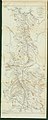
 Special Karte des Fürstenthumes Montenegro (Cèrnagora) - HK 1124.jpg 8,984 × 6,075; 11.18 MB
-
 Special Karte des Fürstenthumes Montenegro (Cèrnagora) - HK1125.jpg 8,950 × 6,021; 19.13 MB
-
 Special Karte des Fürstenthumes Montenegro (Cèrnagora) - HK1126.jpg 8,912 × 5,958; 16.38 MB


_-_HK_1124.jpg)
_-_HK1125.jpg)
_-_HK1126.jpg)