Category:1860s maps of Germany
Countries of Europe: Albania · Armenia‡ · Austria · Azerbaijan‡ · Belarus · Belgium · Bosnia and Herzegovina · Bulgaria · Croatia · Cyprus‡ · Czech Republic · Denmark · Estonia · Finland · France‡ · Georgia‡ · Germany · Greece · Hungary · Republic of Ireland · Italy · Latvia · Lithuania · Moldova · Montenegro · Netherlands‡ · Norway · Poland · Portugal‡ · Romania · Russia‡ · Serbia · Slovenia · Spain‡ · Sweden · Switzerland · Turkey‡ · Ukraine · United Kingdom
Limited recognition: Abkhazia‡
‡: partly located in Europe
Limited recognition: Abkhazia‡
‡: partly located in Europe
Federal states of Germany:
Subcategories
This category has the following 27 subcategories, out of 27 total.
B
- 1860s maps of Berlin (11 F)
- 1860s maps of Brandenburg (3 F)
H
- 1860s maps of Hesse (7 F)
L
- 1860s maps of Lower Saxony (6 F)
M
N
P
- 1860s maps of Prussia (11 F)
R
S
- 1860s maps of Saarland (1 F)
- 1860s maps of Saxony (7 F)
- 1860s maps of Saxony-Anhalt (1 F)
- 1860s maps of Schleswig-Holstein (13 F)
T
Media in category "1860s maps of Germany"
This category contains only the following file.
-
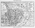 Stadtplan-2-Bahnhöfe.jpg 1,200 × 973; 425 KB
