Category:1820s maps of Ireland
Countries of Europe: Albania · Armenia‡ · Austria · Azerbaijan‡ · Belgium · Bulgaria · Croatia · Czech Republic · Denmark · Estonia · Finland · France‡ · Georgia‡ · Germany · Greece · Republic of Ireland · Italy · Latvia · Lithuania · Montenegro · Netherlands‡ · Norway · Poland · Portugal‡ · Romania · Russia‡ · Serbia · Slovenia · Spain‡ · Sweden · Switzerland · Turkey‡ · Ukraine · United Kingdom
Limited recognition: Abkhazia‡
‡: partly located in Europe
Limited recognition: Abkhazia‡
‡: partly located in Europe
Media in category "1820s maps of Ireland"
The following 9 files are in this category, out of 9 total.
-

-
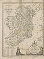 Wilson's 1820 Map of the Roads of Ireland with all the Post Towns.jpg 4,246 × 5,631; 5.59 MB
-
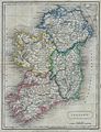 1822 Butler Map of Ireland - Geographicus - Ireland-butler-1822.jpg 2,317 × 3,032; 1.65 MB
-

-
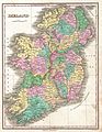 1827 Finley Map of Ireland - Geographicus - Ireland-finley-1827.jpg 2,334 × 3,000; 2.06 MB
-

-

-

-
 Island Eddy, Co. Galway, Ireland on Nimmo's maritime map of Galway Bay, 1822.jpg 2,592 × 1,936; 1.98 MB
_The_4th_edition,_corrected_and_enlarged,_with_an_entire_new_set_of_plates%27_(11005057056).jpg)


.jpg)

.jpg)
.jpg)
.jpg)
