Category:1870s maps of Ireland
Countries of Europe: Armenia‡ · Austria · Azerbaijan‡ · Belgium · Bosnia and Herzegovina · Bulgaria · Croatia · Cyprus‡ · Czech Republic · Denmark · Finland · France‡ · Georgia‡ · Germany · Greece · Hungary · Republic of Ireland · Italy · Latvia · Lithuania · Luxembourg · Netherlands‡ · Norway · Poland · Portugal‡ · Romania · Russia‡ · Serbia · Slovenia · Spain‡ · Sweden · Switzerland · Turkey‡ · Ukraine · United Kingdom
Limited recognition: Abkhazia‡
‡: partly located in Europe
Limited recognition: Abkhazia‡
‡: partly located in Europe
Media in category "1870s maps of Ireland"
The following 17 files are in this category, out of 17 total.
-

-

-
-
-
 GODKIN&WALKER(1871) MAP OF IRELAND.jpg 3,183 × 4,261; 5.53 MB
-

-
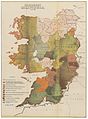
 The Collegiate Atlas 1876 (82450782).jpg 6,848 × 8,378; 7.27 MB
-

-
 347 of '(The Great Ice Age and its relation to the antiquity of man.)' (11117192226).jpg 3,328 × 4,980; 3.23 MB
-

-

-

-

-

-

-

-
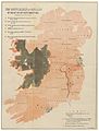
 Irishin1871.jpg 793 × 967; 614 KB
.jpg)
_p_451_Map_of_Tipperary,_as_divided_between_the_Adventurers_and_Soldiers.jpg)
_p_415_Map_of_the_Settlement_of_Ireland_by_the_Act_of_26th_September,_1653.jpg)
_p_438_Map_of_Connaught,_as_laid_out_to_receive_the_Inhabitants_from_the_several_Counties_ofthe_other_Provinces,_A.D._1654.jpg)
_MAP_OF_IRELAND.jpg)
.jpg)
.jpg)
%27_(11117266625).jpg)
%27_(11117192226).jpg)
%27.jpg)
%27_(11028730616).jpg)
%27_(11124561865).jpg)
.jpg)
%27_(11087194575).jpg)
.jpg)
.jpg)
