Category:1870s maps of Bulgaria
Countries of Europe: Armenia‡ · Austria · Azerbaijan‡ · Belgium · Bosnia and Herzegovina · Bulgaria · Croatia · Cyprus‡ · Czech Republic · Denmark · Finland · France‡ · Georgia‡ · Germany · Greece · Hungary · Republic of Ireland · Italy · Latvia · Lithuania · Luxembourg · Netherlands‡ · Norway · Poland · Portugal‡ · Romania · Russia‡ · Serbia · Slovenia · Spain‡ · Sweden · Switzerland · Turkey‡ · Ukraine · United Kingdom
Limited recognition: Abkhazia‡
‡: partly located in Europe
Limited recognition: Abkhazia‡
‡: partly located in Europe
Media in category "1870s maps of Bulgaria"
The following 22 files are in this category, out of 22 total.
-
-

-
-

-

-

-

-
 68 of 'The Defence of Plevna, 1877. Written by One who took part in it' (11231876105).jpg 3,511 × 2,472; 2.08 MB
-
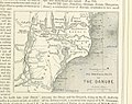
 1877 - Stanford’s popular map of the seat of the Russo-Turkish War of 1877–78.jpg 8,534 × 6,016; 10.13 MB
-

-

-

-
-

-
-

-

-
 MAP OF THE DISTRICT AROUND PHILIPPOPOLIS ACCOMPANYING “UNDER THE BALKANS”.jpg 3,796 × 2,185; 1.49 MB
-

-

-
 SKETCH MAP SHEWING AMBULANCE ROUTE.jpg 1,024 × 717; 217 KB
-
 Карта Балкан по Сан-Стефанскому миру.jpg 1,912 × 1,465; 1.06 MB
%27_(11253112224).jpg)
_With_numerous_maps_and_notes%27_(11111557033).jpg)
_With_numerous_maps_and_notes%27_(11108381555).jpg)
_With_numerous_maps_and_notes%27_(11109114023).jpg)
_With_numerous_maps_and_notes%27_(11108353825).jpg)
_With_numerous_maps_and_notes%27_(11110341044).jpg)
_With_numerous_maps_and_notes%27_(11109755666).jpg)
.jpg)

_With_numerous_maps_and_notes%27_(11108287616).jpg)
_With_numerous_maps_and_notes%27_(11110192463).jpg)
_With_numerous_maps_and_notes%27_(11108807586).jpg)
_With_numerous_maps_and_notes%27_(11109594983).jpg)

%D0%9D%D0%B5%D1%87%D0%B0%D0%B5%D0%B2.jpg)
_With_numerous_maps_and_notes%27_(11109697273).jpg)
_With_numerous_maps_and_notes%27_(11111181663).jpg)


