Category:1870s maps of Romania
Countries of Europe: Armenia‡ · Austria · Azerbaijan‡ · Belgium · Bosnia and Herzegovina · Bulgaria · Croatia · Cyprus‡ · Czech Republic · Denmark · Finland · France‡ · Georgia‡ · Germany · Greece · Hungary · Republic of Ireland · Italy · Latvia · Lithuania · Luxembourg · Netherlands‡ · Norway · Poland · Portugal‡ · Romania · Russia‡ · Serbia · Slovenia · Spain‡ · Sweden · Switzerland · Turkey‡ · Ukraine · United Kingdom
Limited recognition: Abkhazia‡
‡: partly located in Europe
Limited recognition: Abkhazia‡
‡: partly located in Europe
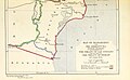
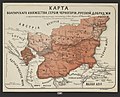
Media in category "1870s maps of Romania"
The following 12 files are in this category, out of 12 total.
-
 Dolhestii Mari pe harta in 1873.jpg 1,460 × 807; 1.73 MB
-

-

-

-
 Cluj-Napoca BV043865846.jpg 14,406 × 11,102; 31.43 MB
-
 68 of 'The Defence of Plevna, 1877. Written by One who took part in it' (11231876105).jpg 3,511 × 2,472; 2.08 MB
-
 1877 - Stanford’s popular map of the seat of the Russo-Turkish War of 1877–78.jpg 8,534 × 6,016; 10.13 MB
-

-
-
-

-
 Карта Балкан по Сан-Стефанскому миру.jpg 1,912 × 1,465; 1.06 MB

_With_numerous_maps_and_notes%27_(11109114023).jpg)
_With_numerous_maps_and_notes%27_(11111342845).jpg)
_With_numerous_maps_and_notes%27_(11108499893).jpg)

.jpg)

_With_numerous_maps_and_notes%27_(11108807586).jpg)
_With_numerous_maps_and_notes%27_(11109594983).jpg)
%D0%9D%D0%B5%D1%87%D0%B0%D0%B5%D0%B2.jpg)

