Category:1838 maps
| ← 1830 1831 1832 1833 1834 1835 1836 1837 1838 1839 → |
Deutsch: Karten mit Bezug zum Jahr 1838
English: Maps related to the year 1838
Español: Mapas relativos al año 1838
Français : Cartes concernant l’an 1838
Русский: Карты 1838 года
Subcategories
This category has the following 8 subcategories, out of 8 total.
Media in category "1838 maps"
The following 195 files are in this category, out of 195 total.
-
-
 BAYLEY(1838) Darjeeling Map1.jpg 2,890 × 4,198; 3.27 MB
-
 BAYLEY(1838) Darjeeling Map2.jpg 1,541 × 2,533; 1.08 MB
-
 BAYLEY(1838) Map of the Country between Titaleea and Dorjeling.jpg 2,907 × 4,160; 2.6 MB
-
 Plan de Paris 1838.jpg 4,325 × 3,287; 9.94 MB
-
 (1838) PLAN VON DER SCHLACHT BEI GROCHOW 1831.jpg 2,621 × 2,237; 2.95 MB
-
 WELLSTED(1838) p2.490 THE PENINSUOLA OF MOUNT SINAI.jpg 1,539 × 2,343; 1.43 MB
-
 1838 Bradford Map of Virginia - Geographicus - Virginia-bradford-1838.jpg 3,500 × 2,712; 2.73 MB
-
 1838 Southern New England railroad map.jpg 7,204 × 6,096; 39.17 MB
-
 KOVALEVSKY(1841) p171 Karte von Montenegro im Jahre 1838.jpg 4,225 × 5,111; 8.18 MB
-

-

-
 A map of Cambridge, Mass. LOC 75697136.tif 7,768 × 5,672; 126.06 MB
-
 A Map of the Hawaiian Islands. According to the Latest Surveys, 1838.jpg 13,236 × 8,698; 35.49 MB
-
 Albany County.) NYPL433706.tiff 3,932 × 5,056; 56.88 MB
-
 Albany. NYPL433705.tiff 3,932 × 5,056; 56.88 MB
-
 Allegany County. NYPL1401743.tiff 3,932 × 5,056; 56.88 MB
-
 Aqueduc de Fréjus décrit dans le cadastre napoléonien (AD-83=.jpg 633 × 500; 179 KB
-
 Auburn. NYPL1401746.tiff 3,841 × 5,056; 55.57 MB
-
 Auguste Henri Dufour, Plan of Jerusalem (FL6881043 2368054).jpg 2,300 × 2,673; 3.06 MB
-
 Aïn Mahdi 1838.JPG 2,680 × 3,150; 721 KB
-
 Baltimore Street Map, 1838.jpg 2,901 × 2,327; 2.43 MB
-
 Baltimore. NYPL433882.tiff 3,932 × 4,367; 49.13 MB
-
 Broome County. NYPL1401744.tiff 3,841 × 5,056; 55.57 MB
-
 Buffalo. NYPL433875.tiff 3,910 × 5,056; 56.57 MB
-
 Canaan, as divided by Joshua among the tribes of Israel (FL37121901 3898145).jpg 2,811 × 4,073; 6.36 MB
-
 Carte d'Annam de 1838 05008.jpg 2,699 × 4,701; 2.96 MB
-
 Carte du département de l'Indre - 1838.jpg 5,462 × 4,504; 2.57 MB
-

-
 Carte routière du département de la Dordogne.jpg 11,252 × 10,240; 9.47 MB
-

-
 Cattaraugus County. NYPL1401745.tiff 3,841 × 5,056; 55.57 MB
-
 Cayuga County NYPL433704.tiff 2,208 × 4,584; 28.99 MB
-
 Celestial table globe RMG D7259-1.tiff 2,713 × 3,800; 29.5 MB
-
 Celestial table globe RMG F7317.tiff 3,600 × 4,800; 49.44 MB
-
 Celestial table globe RMG F8648.tiff 3,600 × 4,800; 49.44 MB
-

-

-

-
-

-
 Chautauque County. NYPL1401747.tiff 5,133 × 4,259; 62.55 MB
-
 Chemung and Tioga Counties. NYPL1401768.tiff 3,985 × 5,010; 57.13 MB
-
 Chenango County. NYPL1401748.tiff 3,841 × 5,056; 55.57 MB
-
 Clinton County. NYPL1401749.tiff 3,841 × 5,056; 55.59 MB
-
 Columbia County.) NYPL433692.tiff 3,841 × 5,056; 55.57 MB
-
 Cortland County. NYPL1401750.tiff 4,054 × 5,056; 58.67 MB
-
 Dease and Simpson - Arctic expedition 1837.png 2,395 × 1,414; 288 KB
-
 Delaware County. NYPL1401752.tiff 3,910 × 5,056; 56.57 MB
-
 Delaware LOC 2017593558.jpg 4,056 × 4,908; 2.26 MB
-
 Delaware LOC 2017593558.tif 4,056 × 4,908; 56.95 MB
-
 Dutchess County.) NYPL433872.tiff 6,020 × 4,840; 83.36 MB
-
 Echelsbacher Ammerfurt.jpg 1,112 × 806; 787 KB
-
 Erie County.) NYPL433874.tiff 3,910 × 5,056; 56.57 MB
-
 Essex County. NYPL1401751.tiff 4,054 × 5,056; 58.65 MB
-

-
 Franklin County. NYPL1401753.tiff 3,963 × 5,056; 57.33 MB
-

-
 Frederick Catherwood, Plan of Jerusalem (FL6880361 2370250).jpg 2,140 × 2,925; 3.01 MB
-

-
 Gambier Islands 1838 map.jpg 5,705 × 7,321; 5.99 MB
-
 Gardiners Point, the northern tip of Gardiners Island.jpg 2,098 × 2,907; 1.9 MB
-
 Genesee County. NYPL1401754.tiff 3,963 × 5,056; 57.33 MB
-
 Greene County.) NYPL433687.tiff 3,985 × 5,056; 57.65 MB
-
 Hamilton County. NYPL1401759.tiff 4,092 × 5,102; 59.76 MB
-
 Herkimer County.) NYPL433686.tiff 3,940 × 5,102; 57.52 MB
-
 Hicks Island, Napeague Harbor, south east top of Long Island, NOAA 1937.jpg 3,470 × 2,594; 2.19 MB
-

-
 Hudson. NYPL433703.tiff 3,841 × 5,056; 55.57 MB
-
 Isotherms Berghaus.jpg 6,292 × 4,950; 29.54 MB
-
 Ithaca Village. NYPL1401770.tiff 3,985 × 5,041; 57.48 MB
-
 Jefferson County. NYPL433877.tiff 3,856 × 5,102; 56.29 MB
-
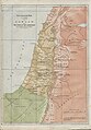
 Jerusalem and places adjacent (FL6881974 2368002).jpg 2,700 × 2,265; 1.83 MB
-
 John Jr Wiltberger, Temperance Map, 1838 Cornell CUL PJM 1049 01.jpg 4,637 × 4,014; 4.88 MB
-
 Karl Georg von Raumer, Zug der Israeliten aus Aegypten nach Canaan (FL164011293 2369787).jpg 5,509 × 4,755; 16.61 MB
-
 Karte-Saazer-Kreis-1838.jpg 1,544 × 1,956; 1.52 MB
-
 Kauai 1838 map by Kalama.jpg 520 × 387; 148 KB
-
 Kilc and Kilc Br, 1838, Soc Diff Useful Knowledge.jpg 270 × 192; 44 KB
-
 King's County, Richmond County.) NYPL1406914.tiff 921 × 1,338; 3.54 MB
-
 Land of Canaan, during the lives of the Patriarchs (FL37121927 3898168).jpg 2,839 × 4,082; 6.55 MB
-
 Map of Gardiners Island from 1834-1845.jpg 4,313 × 7,245; 9.26 MB
-

-

-
 Map of the city of Cincinnati LOC 2004629233.jpg 12,510 × 8,999; 18.37 MB
-
 Map of the city of Cincinnati LOC 2004629233.tif 12,510 × 8,999; 322.09 MB
-
 Map of the practicable routes of a canal from Baltimore to the Potomak LOC 2006636628.jpg 6,264 × 5,112; 3.68 MB
-
 Map of the practicable routes of a canal from Baltimore to the Potomak LOC 2006636628.tif 6,264 × 5,112; 91.61 MB
-
 Map of Warren County, Pennsylvania LOC 2012590193.tif 11,014 × 7,774; 244.97 MB
-
 Modern Palestine, with the adjacent part of Syria (FL37121930 3898163).jpg 2,765 × 4,063; 4.66 MB
-
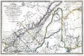 New Map of the Province of Lower Canada.jpg 1,380 × 921; 434 KB
-
 New York - by H.S. Tanner; engraved ... by H.S. Tanner. NYPL434742.tiff 5,004 × 4,414; 63.2 MB
-
 Niagara County.) NYPL433873.tiff 3,158 × 3,575; 32.31 MB
-
 Niagara Falls and vicinity. NYPL433866.tiff 3,985 × 5,010; 57.13 MB
-
 NOAA image of Plum Island, 1937.jpg 3,019 × 1,738; 1.29 MB
-
 Maryland (NYPL b15317388-434434).jpg 5,120 × 5,883; 5.4 MB
-
 Maryland (NYPL b15317388-434434).tiff 5,120 × 5,883; 86.18 MB
-
 Coast chart from Cape Hatteras to Cape Fear, North Carolina (NYPL b18890879-5387000).tiff 7,760 × 10,328, 2 pages; 229.57 MB
-
 Coast chart from Cape Hatteras to Cape Fear, North Carolina (NYPL b18890879-5387001).tiff 7,760 × 10,328, 2 pages; 229.57 MB
-
 Coast chart from Cape Hatteras to Cape Fear, North Carolina (NYPL b18890879-5387002).tiff 13,320 × 10,180; 388.18 MB
-
 Oneida County.) NYPL433696.tiff 3,948 × 5,102; 57.63 MB
-
 Onondaga County. NYPL1401761.tiff 3,948 × 5,102; 57.63 MB
-
 Ontario County.) NYPL433714.tiff 3,181 × 4,168; 37.94 MB
-
 Orange County.) NYPL433695.tiff 5,056 × 4,016; 58.1 MB
-
 Orleans County.) NYPL433709.tiff 3,856 × 5,140; 56.71 MB
-
 Oswego County. NYPL1403561.tiff 5,099 × 4,071; 59.4 MB
-
 Oswego. NYPL433709 1.tiff 3,856 × 5,140; 56.73 MB
-
 Otsego County. NYPL1401763.tiff 3,856 × 5,140; 56.71 MB
-
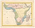 P. Bineteau, Carte de L'Afrique (FL13723667 2493577).jpg 5,168 × 4,129; 30.05 MB
-

-
 P. Bineteau, Carte de la Turquie d'Asia (FL35868084 2714934).jpg 7,518 × 6,002; 60.33 MB
-
 Plan de l attaque de Vera Cruz 1838.jpg 3,664 × 2,534; 1.31 MB
-
 Plattegrond stad Utrecht door Van der Monde in 1838.jpg 2,933 × 2,232; 771 KB
-
 Putnam County.) NYPL433857.tiff 3,105 × 3,112; 27.65 MB
-
 Queen's County.) NYPL433680.tiff 1,386 × 2,145; 8.51 MB
-
 Rensselaer County.) NYPL433683.tiff 3,894 × 5,010; 55.82 MB
-
 Rhode Island (7537854446).jpg 1,608 × 2,000; 2.53 MB
-
 Robbins Island, New York.jpg 1,590 × 2,609; 1.02 MB
-
 Rochester City. NYPL1401758.tiff 4,092 × 5,102; 59.74 MB
-
 Rockland County.) NYPL433682.tiff 3,181 × 3,241; 29.5 MB
-
 Saint Lawrence County. NYPL1401764.tiff 3,940 × 5,010; 56.48 MB
-
 Saratoga County.) NYPL433701.tiff 3,993 × 5,010; 57.24 MB
-
 Schenectady County.) NYPL433700.tiff 4,023 × 5,010; 57.67 MB
-
 Schloss Rosenstein, 043.jpg 2,597 × 1,855; 2.38 MB
-
 Schoharie County. NYPL1401765.tiff 3,985 × 5,010; 57.13 MB
-
 Seneca County.) NYPL252952 25.tiff 3,105 × 3,325; 29.54 MB
-
 Sidney Hall, A map of Canaan, with the portion of the tribes (FL6878869 2508834).jpg 2,200 × 2,866; 2.31 MB
-
 Sidney Hall, Map of Judea (FL6879533 2508848).jpg 2,180 × 2,848; 1.96 MB
-
 Sidy. Hall, A map of Canaan with the portions of the Tribes (FL200036981 2368472).jpg 3,056 × 3,872; 16.33 MB
-
 Sidy. Hall, Map of Asia Minor and the adjacent countries (FL200036789 2368471).jpg 3,726 × 3,140; 16.27 MB
-
 Sidy. Hall, Map of Judea (FL200036665 2368473).jpg 3,089 × 3,905; 15.82 MB
-
 Sketch of the Cilician and Syrian Passes, 1838.jpg 469 × 604; 202 KB
-
 Sketch of the Niagara River. NYPL435013.tiff 4,672 × 4,724; 63.15 MB
-
 Steuben County. NYPL1401766.tiff 3,985 × 5,010; 57.13 MB
-
 Stockholm karta 1836.jpg 4,739 × 3,975; 7.03 MB
-
 Suffolk County.) NYPL433699.tiff 3,985 × 5,010; 57.13 MB
-
 Sullivan County. NYPL1401767.tiff 3,985 × 5,010; 57.13 MB
-
 Syracuse and Salina villages.) NYPL433694.tiff 5,102 × 3,963; 57.85 MB
-
 T45-2-li.jpg 10,392 × 9,344; 9.58 MB
-
 T49-li.jpg 13,392 × 9,273; 11.53 MB
-
 T50-li.jpg 12,617 × 9,469; 7.22 MB
-
 T51-li.jpg 13,441 × 9,938; 9.26 MB
-
 T52-1.jpg 13,442 × 9,121; 6.27 MB
-
 T52-2.jpg 13,342 × 9,020; 7.32 MB
-
 T55-1.jpg 13,630 × 9,159; 7.21 MB
-
 T55-2.jpg 13,605 × 9,035; 7.33 MB
-
 T56-1.jpg 5,664 × 3,480; 4.46 MB
-
 T56-2.jpg 5,245 × 3,463; 5.12 MB
-
 T58-1.jpg 13,206 × 9,509; 9.09 MB
-
 T58-2.jpg 13,256 × 9,660; 7.68 MB
-
 T59-1.jpg 13,206 × 9,638; 6.47 MB
-
 T59-2.jpg 13,555 × 9,060; 7.5 MB
-
 T60-1.jpg 13,281 × 8,834; 5.48 MB
-
 T60-2.jpg 11,942 × 8,157; 6.3 MB
-
 T62-li.jpg 13,480 × 9,535; 8.6 MB
-
 T66.jpg 12,501 × 9,237; 4.23 MB
-
 T67-1.jpg 13,256 × 9,060; 7.02 MB
-
 T67-2.jpg 13,031 × 9,061; 7 MB
-
 T68-li.jpg 11,508 × 8,806; 3.83 MB
-
 T69-li.jpg 8,634 × 11,783; 5.25 MB
-
 T70-1.jpg 13,156 × 8,440; 6.42 MB
-
 T70-2.jpg 12,357 × 8,188; 7.13 MB
-
 T71.jpg 9,060 × 10,263; 6.51 MB
-
 T73.jpg 10,984 × 9,085; 5.72 MB
-
 T74.jpg 11,687 × 7,588; 6.13 MB
-
 T75-li.jpg 8,561 × 11,618; 6.47 MB
-
 T76.jpg 12,657 × 9,485; 5.7 MB
-
 T77-1.jpg 9,211 × 12,377; 5.97 MB
-
 T77-2.jpg 9,452 × 12,711; 4.38 MB
-
 T77-3.jpg 9,385 × 12,772; 4.42 MB
-
 T80.jpg 12,457 × 9,877; 6.66 MB
-
 T82-1.jpg 11,808 × 8,501; 5.31 MB
-
 T82-2.jpg 11,807 × 8,662; 5.21 MB
-
 T82-3.jpg 11,926 × 9,246; 4.5 MB
-

-
 Tagdemt 1838.JPG 2,800 × 3,300; 949 KB
-
 The hand-book for travellers in Italy, from London to Naples (1838) (14796314973).jpg 1,890 × 2,922; 508 KB
-
 The Kingdoms of Judah and Israel (FL37121933 3898146).jpg 2,811 × 4,073; 6.9 MB
-
 The second town plan of Perth, in 1838.jpg 480 × 283; 151 KB
-
 Tompkins County. NYPL1401769.tiff 6,972 × 5,428; 108.27 MB
-

-

-
 Troy. NYPL433702.tiff 3,894 × 5,010; 55.82 MB
-
 Ulster County.) NYPL433698.tiff 3,985 × 5,041; 57.48 MB
-
 Urkarte Rottweil Judengasse.pdf 1,754 × 1,239; 4.59 MB
-
 Utica. NYPL433684.tiff 3,948 × 5,102; 57.63 MB
-
 Venezia cartina illustrazione di b r davies 01.gif 1,832 × 2,410; 2.91 MB
-
 Venezia cartina illustrazione di w b clarke 01.gif 1,826 × 2,410; 2.98 MB
-
 Warren County. NYPL1401771.tiff 3,985 × 5,010; 57.13 MB
-
 Warttuerme um Fulda.jpg 2,136 × 2,648; 440 KB
-
 Washington County. NYPL1401772.tiff 3,985 × 5,010; 57.13 MB
-
 Wayne County.) NYPL433859.tiff 3,841 × 5,056; 55.57 MB
-
 Westchester County.) NYPL433697.tiff 3,985 × 5,010; 57.13 MB
-
 Yates County. NYPL1401757.tiff 9,936 × 6,665; 189.49 MB
-
 YucatanWaldec1838Map.jpg 772 × 1,237; 791 KB
-
 Давыдково на карте 1838 года.jpg 5,180 × 3,814; 4.28 MB
)%27_(11015265853).jpg)
_Darjeeling_Map1.jpg)
_Darjeeling_Map2.jpg)
_Map_of_the_Country_between_Titaleea_and_Dorjeling.jpg)

_PLAN_VON_DER_SCHLACHT_BEI_GROCHOW_1831.jpg)
_p2.490_THE_PENINSUOLA_OF_MOUNT_SINAI.jpg)


_p171_Karte_von_Montenegro_im_Jahre_1838.jpg)

)%27_(11015394196).jpg)


.jpg)


.jpg)


_-_from_the_third_London_edition_(1838)_(20592301636).jpg)
.jpg)


.jpg)
.jpg)
.jpg)


.jpg)

.jpg)


.jpg)

_LOC_2007630456.jpg)


.jpg)


.jpg)
.jpg)
.jpg)
.jpg)


.jpg)


.jpg)
.jpg)
.jpg)
.jpg)
.jpg)


_(14796314973).jpg)
.jpg)


