Category:1840s maps of Massachusetts
States of the United States: Alabama · Alaska · Arkansas · California · Connecticut · Delaware · Florida · Georgia · Hawaii · Idaho · Illinois · Indiana · Iowa · Kentucky · Louisiana · Maine · Maryland · Massachusetts · Michigan · Minnesota · Mississippi · Missouri · Montana · Nebraska · New Hampshire · New Mexico · New York · North Dakota · Ohio · Oklahoma · Oregon · Pennsylvania · Rhode Island · South Carolina · South Dakota · Tennessee · Texas · Utah · Vermont · Virginia · Washington · Wisconsin · Wyoming – Washington, D.C.
Puerto Rico
Puerto Rico
Subcategories
This category has the following 10 subcategories, out of 10 total.
- 1840 maps of Massachusetts (6 F)
- 1841 maps of Massachusetts (6 F)
- 1842 maps of Massachusetts (11 F)
- 1843 maps of Massachusetts (5 F)
- 1844 maps of Massachusetts (5 F)
- 1848 maps of Massachusetts (8 F)
- 1849 maps of Massachusetts (12 F)
B
Media in category "1840s maps of Massachusetts"
The following 4 files are in this category, out of 4 total.
-
 1845 North Billerica Map (IA 1845NorthBillerica).pdf 2,004 × 1,604; 826 KB
-
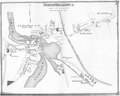
 Map of that section of the town of Nantucket... (2674746217).jpg 1,541 × 2,000; 2.97 MB
-
 Map of rail road surveys from Worcester to Baldwinville & N.H. line. LOC 98688493.jpg 4,855 × 5,625; 4.66 MB
-
 Map of rail road surveys from Worcester to Baldwinville & N.H. line. LOC 98688493.tif 4,855 × 5,625; 78.13 MB
.jpg)
