Category:1846 maps of Massachusetts
States of the United States: California · Maryland · Massachusetts · New Jersey · New Mexico · New York · Ohio · Oregon · Pennsylvania · Texas · Utah – Washington, D.C.
| ← 1840 1841 1842 1843 1844 1846 1847 1848 1849 → |
Subcategories
This category has only the following subcategory.
Media in category "1846 maps of Massachusetts"
The following 16 files are in this category, out of 16 total.
-
 1846 National Theatre Boston map byGGSmith detail BPL 10581.png 815 × 715; 904 KB
-
 1846 NationalTheatre Boston map byGGSmith detail BPL 10581.png 815 × 715; 1.04 MB
-
 1846 sketch of proposed canal from Pawtucket Dam to Western Canal; Lowell, MA.tiff 5,000 × 3,208; 15.3 MB
-

-
 A Map of Methuen, Mass. (4579319884).jpg 8,761 × 6,392; 15.55 MB
-
 A map of Plymouth Village, 1846 (3720083929).jpg 1,024 × 823; 669 KB
-
-
-
 Massachusetts map by George W. Boynton, 1846.jpg 4,035 × 2,961; 20.92 MB
-

-
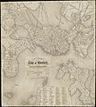
 Plan of Boston comprising a part of Charlestown and Cambridge (2674674844).jpg 1,864 × 2,000; 3.44 MB
-
 Plan of lots on O Street, South Boston (9472186893).jpg 799 × 490; 48 KB
-
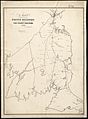
 Plan of the survey of Massachusetts, published 1846.jpg 5,975 × 3,657; 5.39 MB
-

-

-


_-_Geographicus_-_Nantucket-uscs-1846.jpg)
.jpg)
.jpg)
.jpg)
.jpg)

_(14577002850).jpg)
.jpg)
.jpg)


.jpg)