Category:1840s maps of the Balkans
English: This category is intended to collect maps from the 1840s that show multiple Balkan countries in one map frame.
| 19th-century maps of the Balkans: ← 1800s 1810s 1820s 1830s 1840s 1850s 1860s 1870s 1880s 1890s → |
Subcategories
This category has the following 6 subcategories, out of 6 total.
Media in category "1840s maps of the Balkans"
The following 16 files are in this category, out of 16 total.
-
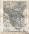
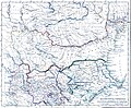
 Balkan-Halbinsel, Ungarn, Europaeische Türkey und Griechenland.tif 3,360 × 4,125; 39.69 MB
-
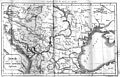
 1843 map of the Danube.jpg 17,664 × 12,401; 38.16 MB
-
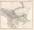
 1846 map - Europaeische Türkey, Griechenland und die Ionischen Inseln.tif 5,398 × 6,323; 80.02 MB
-
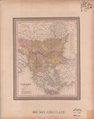 1846 map of Turkey in Europe.tif 8,128 × 10,314; 171.69 MB
-

-

-
 Balkankarte-1848.jpg 4,252 × 2,736; 7.52 MB
-
 Die europäische Türkey Platt 1848.pdf 2,845 × 2,470; 768 KB
-

-

-
 Dacia Aureliana - 1849.jpg 1,821 × 885; 936 KB
-
 Ethnographic map Ami Boué, 1847.jpg 2,364 × 2,348; 1.83 MB
-
 Macedonia-Thracia-Illyria-Moesia-Dacia1849.jpg 2,038 × 1,677; 1.12 MB
-
 Macedonia-Thracia-Illyria-Moesia-Dacia1849refurbished.jpg 2,038 × 1,677; 837 KB
-
 Neueste Special & Kriegs-Karte der Europäischen Türkey in IV Blättern - Albania and Crete.jpg 11,389 × 9,023; 20.68 MB
-
 Roman Empire Map AlexanderFindlay1849.png 2,038 × 1,828; 2 MB


