Category:1887 maps of Connecticut
States of the United States: California · Connecticut · Florida · Georgia · Illinois · Indiana · Iowa · Kansas · Louisiana · Maine · Massachusetts · Michigan · Minnesota · Mississippi · Missouri · New Hampshire · New Jersey · New York · North Carolina · Ohio · Pennsylvania · South Dakota · Tennessee · Texas · Utah · Vermont · Virginia · Washington · Wisconsin · Wyoming
| 1881 1883 1884 1885 1886 1887 1888 1889 → |
Subcategories
This category has the following 2 subcategories, out of 2 total.
Media in category "1887 maps of Connecticut"
The following 4 files are in this category, out of 4 total.
-
 Rand, Mac Nally & Co's Connecticut - btv1b530584164.jpg 4,388 × 3,414; 2.59 MB
-
-

-
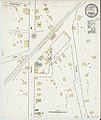
 Sanborn Fire Insurance Map from Stratford, Fairfield County, Connecticut, 1887, Plate 0001.tiff 6,450 × 7,650; 141.17 MB


