Category:1889 maps of Rhode Island
States of the United States: California · Connecticut · Florida · Georgia · Illinois · Indiana · Iowa · Kansas · Kentucky · Louisiana · Maine · Massachusetts · Michigan · Minnesota · Mississippi · Missouri · Montana · New Hampshire · New Jersey · New Mexico · New York · Ohio · Oregon · Pennsylvania · Rhode Island · South Carolina · Tennessee · Texas · Utah · Vermont · Washington · Wisconsin
| 1885 1886 1889 → |
Subcategories
This category has only the following subcategory.
Media in category "1889 maps of Rhode Island"
The following 7 files are in this category, out of 7 total.
-
 Arbuckle Bros. Coffee Company (3092974583).jpg 798 × 474; 269 KB
-
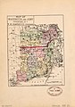 Map of Washington and Kent Counties, R.I. LOC 80693470.jpg 2,115 × 3,017; 935 KB
-
 Map of Washington and Kent Counties, R.I. LOC 80693470.tif 2,115 × 3,017; 18.26 MB
-

-

-

-

.jpg)
