Category:1890 maps of Vermont
States of the United States: California · Connecticut · Florida · Georgia · Hawaii · Idaho · Illinois · Indiana · Iowa · Kansas · Kentucky · Louisiana · Maine · Maryland · Massachusetts · Michigan · Minnesota · Mississippi · Missouri · Montana · Nevada · New Hampshire · New Jersey · New Mexico · New York · North Carolina · North Dakota · Ohio · Oklahoma · Oregon · Pennsylvania · Rhode Island · South Carolina · South Dakota · Texas · Utah · Vermont · Virginia · Washington · West Virginia · Wisconsin · Wyoming – Washington, D.C.
| ← 1890 1891 1892 1894 1895 1897 1898 1899 → |
Media in category "1890 maps of Vermont"
The following 6 files are in this category, out of 6 total.
-
 Brandon, Vt. LOC 2008624004.jpg 9,768 × 6,160; 8.33 MB
-
 Brandon, Vt. LOC 2008624004.tif 9,768 × 6,160; 172.15 MB
-
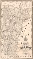
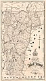 Map of the state of Vermont. LOC 85696909.jpg 4,411 × 7,718; 5.91 MB
-
 Map of the state of Vermont. LOC 85696909.tif 4,411 × 7,718; 97.4 MB
-
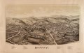
 Vergennes, Vt. LOC 75696633.jpg 9,856 × 6,128; 10.97 MB
-
 Vergennes, Vt. LOC 75696633.tif 9,856 × 6,128; 172.8 MB


