Category:1892 maps of Vermont
States of the United States: California · Connecticut · Florida · Georgia · Idaho · Illinois · Indiana · Iowa · Kansas · Kentucky · Louisiana · Maine · Maryland · Massachusetts · Michigan · Minnesota · Mississippi · Missouri · Montana · New Hampshire · New Jersey · New York · North Carolina · North Dakota · Ohio · Oregon · Pennsylvania · Rhode Island · South Carolina · South Dakota · Tennessee · Texas · Vermont · Washington · West Virginia · Wisconsin – Washington, D.C.
| ← 1890 1891 1892 1894 1895 1897 1898 1899 → |
Media in category "1892 maps of Vermont"
The following 6 files are in this category, out of 6 total.
-

-
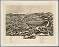 Enosburg Falls, Vt. (2675882158).jpg 2,000 × 1,599; 2.25 MB
-
 Enosburg Falls, Vt., Franklin Co., 1892. LOC 97687305.jpg 6,440 × 4,184; 4.51 MB
-
 Enosburg Falls, Vt., Franklin Co., 1892. LOC 97687305.tif 6,440 × 4,184; 77.09 MB
-
 Hardwick, Vt. 1892. LOC 75696625.jpg 5,920 × 4,824; 5.02 MB
-
 Hardwick, Vt. 1892. LOC 75696625.tif 5,920 × 4,824; 81.71 MB

.jpg)

