Category:1890s maps of Turkey
Countries of Asia: Afghanistan · Armenia‡ · Azerbaijan‡ · People's Republic of China · Cyprus‡ · Egypt‡ · Georgia‡ · India · Indonesia‡ · Iran · Japan · Jordan · Lebanon · Myanmar · Pakistan · Philippines · Russia‡ · Syria · Turkey‡ · Yemen
Limited recognition: Abkhazia‡ · Taiwan · State of Palestine
‡: partly located in Asia
Limited recognition: Abkhazia‡ · Taiwan · State of Palestine
‡: partly located in Asia
Countries of Europe: Albania · Armenia‡ · Austria · Azerbaijan‡ · Belarus · Belgium · Bosnia and Herzegovina · Bulgaria · Croatia · Cyprus‡ · Czech Republic · Denmark · Estonia · Finland · France‡ · Georgia‡ · Germany · Greece · Hungary · Iceland · Republic of Ireland · Italy · Latvia · Lithuania · Montenegro · Netherlands‡ · Norway · Poland · Portugal‡ · Romania · Russia‡ · Serbia · Slovakia · Slovenia · Spain‡ · Sweden · Switzerland · Turkey‡ · Ukraine · United Kingdom
Limited recognition: Abkhazia‡
‡: partly located in Europe
Limited recognition: Abkhazia‡
‡: partly located in Europe
Subcategories
This category has the following 3 subcategories, out of 3 total.
Media in category "1890s maps of Turkey"
The following 15 files are in this category, out of 15 total.
-

-

-

-

-
 Stielers Handatlas 1891 49.jpg 5,150 × 4,250; 6.85 MB
-
 Stielers Handatlas 1891 54.jpg 4,250 × 5,100; 5.87 MB
-

-
 1895 map of the Sea of Marmara.jpg 2,864 × 1,681; 2.01 MB
-

-
 Ahlat 1898 H F B Lynch Armenia Travels and Studies Bd 2 1901 S 296 f.jpg 2,297 × 1,800; 1.4 MB
-
 Carte géologique de la mer Egée par Mr L. de Launay et des régions avoisinantes.jpg 5,992 × 4,313; 3.22 MB
-

-

-
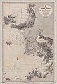 Admiralty Chart No 1546 Samos Strait to Mandelyah Gulf, Published 1898.jpg 8,390 × 12,359; 14 MB
-

_oszt%C3%A1ly_sz%C3%A1mara._(With_maps.)%27_(11206741466).jpg)
.jpg)


.jpg)


%27_(11205270513).jpg)
%27_(11206413614).jpg)

