Category:1890s maps of Latvia
Countries of Europe: Albania · Armenia‡ · Austria · Azerbaijan‡ · Belarus · Belgium · Bosnia and Herzegovina · Bulgaria · Croatia · Cyprus‡ · Czech Republic · Denmark · Estonia · Finland · France‡ · Georgia‡ · Germany · Greece · Hungary · Republic of Ireland · Italy · Latvia · Lithuania · Montenegro · Netherlands‡ · Norway · Poland · Portugal‡ · Romania · Russia‡ · Serbia · Slovakia · Slovenia · Spain‡ · Sweden · Switzerland · Turkey‡ · Ukraine · United Kingdom
Limited recognition: Abkhazia‡
‡: partly located in Europe
Limited recognition: Abkhazia‡
‡: partly located in Europe
Media in category "1890s maps of Latvia"
The following 9 files are in this category, out of 9 total.
-
 BATYUSHKOV(1890) p591.jpg 3,617 × 4,107; 9.65 MB
-
 Image taken from page 332 of 'Histoire d'un siècle' (11203766703).jpg 1,532 × 2,649; 966 KB
-

-
 Meyers leiner Hand-atlas 1893 (73137050).jpg 6,384 × 9,505; 10.23 MB
-
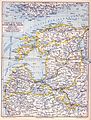 Meyerbaltikum.jpg 1,513 × 2,000; 1.26 MB
-

-

-

-
 Карта волостей Курляндской губернии.jpg 1,966 × 1,495; 623 KB
_p591.jpg)
.jpg)
.jpg)
.jpg)

%27_(11248859715).jpg)
.jpg)
.jpg)
