Category:1922 maps
| ← · 1920 · 1921 · 1922 · 1923 · 1924 · 1925 · 1926 · 1927 · 1928 · 1929 · → |
Deutsch: Karten mit Bezug zum Jahr 1922
English: Maps related to the year 1922
Español: Mapas relativos al año 1922
Français : Cartes concernant l’an 1922
Русский: Карты 1922 года
Subcategories
This category has the following 7 subcategories, out of 7 total.
Media in category "1922 maps"
The following 115 files are in this category, out of 115 total.
-

-
 Crimea 1922.jpg 4,658 × 3,493; 2.58 MB
-
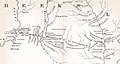
 1922 Kham(Eastern Tibet) by Teichman.jpg 4,872 × 6,303; 7.68 MB
-

-
 2fi2295 Palais Saint-Georges de Rennes.jpg 10,645 × 5,350; 2.84 MB
-
 2Fi2296 Palais Saint-Georges de Rennes.jpg 10,975 × 5,594; 6.77 MB
-
 2fi2297 Palais Saint-Georges de Rennes.jpg 8,363 × 5,661; 1.47 MB
-
 2fi2298 Palais Saint-Georges de Rennes.jpg 8,340 × 5,554; 1.82 MB
-
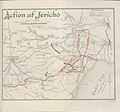 Action at Jericho (FL37128159 3902781).jpg 2,726 × 2,541; 2.54 MB
-
 Aero view of Goshen, New York - 1922. LOC 80695175.jpg 9,984 × 6,944; 13.49 MB
-
 Aero view of Goshen, New York - 1922. LOC 80695175.tif 9,984 × 6,944; 198.35 MB
-
 Amsterdam, Oostelijk Havengebied (1922).jpg 1,200 × 638; 342 KB
-
 Armentières 1922.jpg 3,935 × 2,248; 741 KB
-
 Beothuk and Micmac (1922) (14778388661).jpg 2,532 × 2,010; 917 KB
-
 Bird's-eye-view of Allentown, Pennsylvania. LOC gm71005331.jpg 22,304 × 8,896; 35.95 MB
-
 Bird's-eye-view of Allentown, Pennsylvania. LOC gm71005331.tif 22,304 × 8,896; 567.67 MB
-
 Bird's-eye-view of Allentown, Pennsylvania. LOC gm71005350.jpg 10,752 × 4,640; 8.52 MB
-
 Bird's-eye-view of Allentown, Pennsylvania. LOC gm71005350.tif 10,752 × 4,640; 142.73 MB
-
 Borden County - J.D. Hedick, Draftsman. LOC 2012590173.jpg 11,201 × 12,633; 18.57 MB
-
 Borden County - J.D. Hedick, Draftsman. LOC 2012590173.tif 11,201 × 12,633; 404.84 MB
-
 British Aden 1922.jpg 2,816 × 2,112; 803 KB
-
 Bulletin du Muséum d'histoire naturelle (1922) (19817253464).jpg 2,456 × 3,968; 1.58 MB
-
 Carte itinéraire des routes nationales de France et d'Algérie.jpg 8,064 × 10,284; 10.03 MB
-
 Diagram showing direction of movement of local glaciers, Gaspe Peninsula, Quebec.jpg 2,800 × 1,500; 1.01 MB
-
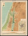 Edinburgh Geographical Institute, Palestine (FL36012252 3896582).jpg 10,860 × 14,060; 211.27 MB
-
 FMIB 49243 Relief map of the sea and land.jpeg 1,087 × 596; 228 KB
-
 Foot traffic in Seattle, Washington, Wednesday, April 26th, 1922. LOC 98687155.jpg 6,518 × 3,517; 3.5 MB
-
 Fort Hull map.jpg 1,384 × 735; 153 KB
-
 Fort Kamehameha map 1922.gif 2,788 × 1,546; 251 KB
-
 Galata map 1922.jpg 815 × 508; 275 KB
-
 Georgian soviet republic1922-corrected.png 1,368 × 836; 62 KB
-
 Georgian soviet republic1922.png 1,368 × 836; 76 KB
-
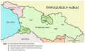 Georgian SSR 1922 hy.png 800 × 489; 97 KB
-
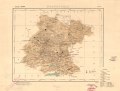
 Graz-Austria map.tif 14,929 × 19,638; 838.82 MB
-
 Graz-center-Austria.tif 14,866 × 8,748; 372.11 MB
-
 Greece and the Aegean (Times Survey Atlas of the World 1922).jpg 901 × 715; 313 KB
-
 Guanajuato LOC 2012592362.jpg 7,124 × 5,420; 4.68 MB
-
 Guanajuato LOC 2012592362.tif 7,124 × 5,420; 110.47 MB
-
 HambergSarekKarta1922.jpg 2,000 × 2,429; 966 KB
-

-
 Innsbruck-austria.tif 14,808 × 19,638; 832.02 MB
-
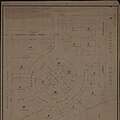
 Jerusalem zoning system - Charles Robert Ashbee 1922.png 5,142 × 6,050; 38.6 MB
-
 Kaart van Beleg van Maastricht (1632) RAL K 221 2.jpg 3,412 × 4,577; 1.44 MB
-
 Louisiade Archipelago 1922 nautical chart.jpg 8,070 × 5,638; 6.07 MB
-
 Maine. LOC 99446117.jpg 5,310 × 6,805; 8.39 MB
-
 Maine. LOC 99446117.tif 5,310 × 6,805; 103.38 MB
-
 Map of Australia with the British Isles.1922.jpg 2,815 × 2,459; 591 KB
-
 Map of Lincoln Highway from Philadelphia to York Pennsylvania.jpg 1,498 × 3,777; 1,023 KB
-
 Map of Morgan County in West Virginia.jpg 2,373 × 1,410; 969 KB
-
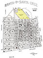 Map of Santa Cruz do Sul, 1922.jpg 1,483 × 1,996; 1 MB
-
 Map of the city of Cambridge (3369706177).jpg 2,000 × 1,109; 2.5 MB
-

-

-
 Middletown, N.Y. 1922. LOC 75694797.jpg 11,104 × 7,952; 13.78 MB
-
 Middletown, N.Y. 1922. LOC 75694797.tif 11,104 × 7,952; 252.63 MB
-
 Mineralogical and railway map of Siberia - (Signé - Colonel G. de Metz) - btv1b53209892h.jpg 12,284 × 9,311; 21.25 MB
-
 Oriental rugs, antique and modern (1922) (14593860680).jpg 3,104 × 1,960; 404 KB
-
 Oriental rugs, antique and modern (1922) (14780547245).jpg 3,088 × 1,952; 409 KB
-
 Oriental rugs, antique and modern (1922) (14780619865).jpg 3,104 × 1,950; 490 KB
-
 Oriental rugs, antique and modern (1922) (14800336313).jpg 3,104 × 1,960; 462 KB
-
 Pearl River Entrance 1922.jpg 13,216 × 12,000; 18.01 MB
-

-
 Plan of Jerusalem (FL66300488 4431322).jpg 8,836 × 8,024; 78.83 MB
-
 Planta das Estradas Municipais de Matão - 1, Acervo do Museu Paulista da USP.jpg 7,216 × 5,412; 19.24 MB
-

-
 Planta do Terreno Conhecido pela Denominação de Chácara - 1, Acervo do Museu Paulista da USP.jpg 5,412 × 7,216; 18.72 MB
-

-
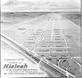 Projection of Hialeah in 1922.jpg 600 × 569; 53 KB
-
 R P Bolton, indicating Native American Paths in Manhattan ,rendered 1922.jpg 1,372 × 1,372; 1.48 MB
-
 Railway map of Palestine & Transjordan (FL10519214 2633127).jpg 7,584 × 6,696; 60.47 MB
-
 Rangiaowhia.jpg 1,281 × 711; 215 KB
-
 Robinson's aeroplane map of Sydney. LOC 00552210.jpg 6,717 × 9,641; 11.1 MB
-
 Robinson's aeroplane map of Sydney. LOC 00552210.tif 6,717 × 9,641; 185.28 MB
-
 Russian Socialist Federated Soviet Republic 1922 LOC 2017586294.jpg 3,582 × 5,636; 2.15 MB
-
 Russian Socialist Federated Soviet Republic 1922 LOC 2017586294.tif 3,582 × 5,636; 57.76 MB
-
 Salzburg-Austria.tif 19,638 × 14,944; 839.66 MB
-
 Salzburg-center-Austria.tif 8,398 × 8,121; 195.17 MB
-
 Samuel Klein, ירושלים והסביבה הקרובה (FL45605216 3942289).jpg 5,100 × 3,400; 4.52 MB
-
 Samuel Klein, מפת ארץ ישראל (FL25570436 2580015).jpg 7,020 × 10,008; 83.53 MB
-
 Samuel Klein, מפת ארץ ישראל. עo מפת רוטויג-אומלויפט (FL43908842 3930435).jpg 3,561 × 4,558; 11.56 MB
-
 San Juan, P.R., North, from Hotel Palace. LOC 98687144.jpg 11,808 × 2,352; 2.65 MB
-
 San Juan, P.R., North, from Hotel Palace. LOC 98687144.tif 11,808 × 2,352; 79.46 MB
-
 Shadow Lawn.jpg 598 × 600; 70 KB
-
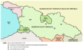
 Soviet caucasus1922.png 1,613 × 1,152; 127 KB
-
 Soviet-caucasus1922.png 1,613 × 1,090; 92 KB
-
 Springvalley-lg2.gif 1,200 × 866; 640 KB
-
 Stadtplan Eger Cheb 1922.jpg 2,925 × 2,925; 1.15 MB
-

-
 Street map of Rockingham, 1922.png 730 × 500; 346 KB
-
 Taksim area in 1922 - detail of Istanbul PU971.jpg 569 × 614; 164 KB
-
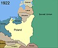 Territorial changes of Poland 1922.jpg 850 × 700; 67 KB
-
 Territorial changes of Poland 1922b.jpg 850 × 700; 219 KB
-
 Territorial changes of Poland 1922c.jpg 761 × 571; 158 KB
-
 The American journal of science (1922) (18150581002).jpg 2,144 × 2,684; 1.13 MB
-
 The Atlantic LOC 2013593219.jpg 11,151 × 13,549; 19.86 MB
-
 The Atlantic LOC 2013593219.tif 11,151 × 13,549; 432.26 MB
-
 The Bell System technical journal (1922) (20177388579).jpg 2,816 × 1,258; 681 KB
-
 The Israel Land Development Company Ltd, Jerusalem (FL10423462 2369549).jpg 2,786 × 3,439; 10.94 MB
-
 The Israel Land Development Company Ltd, גן אנטימוס (FL10423156 2369383).jpg 3,502 × 2,401; 11.13 MB
-
 The Israel Land Development Company Ltd, תכנית יפו-תל אביב (FL6879014 2369679).jpg 3,152 × 2,000; 1.9 MB
-
 The Price & Lee Cos map of Orange (9136153475).jpg 678 × 800; 108 KB
-
 Tour de France 1922.png 1,795 × 1,796; 275 KB
-
 Tournai SNCV.jpg 4,000 × 2,248; 917 KB
-
 Tumulus de Rosmeur 33676.jpg 1,269 × 1,542; 382 KB
-
 Tumulus Rosmeur 33681.jpg 2,294 × 2,095; 1.48 MB
-
 Universiteitsbibliotheek VU - Indo-Chine - carte de la mission Pavie.jpg 3,390 × 4,423; 3.46 MB
-
 Ville de Mazagan 1922.jpg 12,144 × 7,941; 44.96 MB
-
 Virginia Highlands map.JPG 1,412 × 931; 329 KB
-
 Vuelo Gago Coutinho y Sacadura Cabral.svg 556 × 625; 34 KB
-
 Vuelo plus ultra.svg 556 × 625; 47 KB
-
 Vuelos plus ultra y Gago Coutinho-Sacadura Cabral.svg 556 × 625; 40 KB
-
 Washington, the beautiful capital of the nation. LOC 78695115.jpg 14,944 × 8,992; 31.8 MB
-
 Zschaetzsch Atlantis Urheimat der Arier.jpg 763 × 1,230; 638 KB
-
 ZSCHAETZSCH(1922) Karte von Atlantis im Atlantischen Ozean.jpg 795 × 480; 353 KB
-
 ארץ ישראל המושבות (FL45605302 3943364).jpg 1,187 × 1,798; 774 KB


_by_Teichman.jpg)


.jpg)

.jpg)

_(14778388661).jpg)


_(19817253464).jpg)


.jpg)


.jpg)


_RAL_K_221_2.jpg)


.jpg)


_-_btv1b53209892h.jpg)
_(14593860680).jpg)
_(14780547245).jpg)
_(14780619865).jpg)
_(14800336313).jpg)

.jpg)


.jpg)
.jpg)
.jpg)


_(18150581002).jpg)

_(20177388579).jpg)
.jpg)
.jpg)
.jpg)
.jpg)


_Karte_von_Atlantis_im_Atlantischen_Ozean.jpg)
.jpg)
.jpg)
_(9135716285).jpg)