Category:1927 maps
| ← · 1920 · 1921 · 1922 · 1923 · 1924 · 1925 · 1926 · 1927 · 1928 · 1929 · → |
Deutsch: Karten mit Bezug zum Jahr 1927
English: Maps related to the year 1927
Español: Mapas relativos al año 1927
Français : Cartes concernant l’an 1927
Русский: Карты 1927 года
Subcategories
This category has the following 8 subcategories, out of 8 total.
Media in category "1927 maps"
The following 63 files are in this category, out of 63 total.
-
 1927 Atlantic hurricane season map.png 990 × 765; 188 KB
-
 1927 East Bay Electric Lines and Key System map.jpg 5,952 × 3,128; 5.21 MB
-
 1927 East Bay Electric Lines map.jpg 2,880 × 2,083; 954 KB
-
 Aladdin City Florida Land Boom Map 1927.jpg 1,009 × 667; 274 KB
-
 Ana Vatan - (Turkey). LOC 2010593205.jpg 15,793 × 10,476; 22.5 MB
-
 Anavatan 1927 (Balıkesir).jpg 888 × 752; 292 KB
-
 Anavatan 1927 (Samsun).jpg 963 × 616; 229 KB
-
 Anavatan 1927.jpg 9,999 × 6,428; 11.77 MB
-
 Bell telephone magazine (1922) (14753218791).jpg 1,718 × 1,146; 248 KB
-
 Clip map1.jpg 531 × 305; 74 KB
-
 Desventuradas islands (Chile).jpg 393 × 175; 19 KB
-
 DnisterLiman1927.jpg 767 × 918; 167 KB
-
 Everglades 1927.jpg 304 × 443; 53 KB
-
 French Service géographique de l'armée, Zahle (FL147439296 4083425).jpg 13,167 × 18,059; 289.45 MB
-
 General view of harbor at San Juan, Porto Rico looking South. LOC 98687143.jpg 7,927 × 2,787; 3.79 MB
-
 General view of harbor at San Juan, Porto Rico looking South. LOC 98687143.tif 7,927 × 2,787; 63.21 MB
-
 Golden-age-mu-map.jpg 606 × 477; 157 KB
-
 Haifa Bay Development Company, מפרץ חיפה (FL10423492 2538396).jpg 3,420 × 5,340; 21.48 MB
-
 Jezioro ancylusowe001.jpg 349 × 372; 34 KB
-

-

-
 Karta selʹskokhozi︠a︡ĭstvennykh raĭonov Evreĭskoĭ Avtonomnoĭ oblasti. LOC 2018692316.jpg 3,672 × 2,601; 1.36 MB
-
 Karta selʹskokhozi︠a︡ĭstvennykh raĭonov Evreĭskoĭ Avtonomnoĭ oblasti. LOC 2018692316.tif 3,672 × 2,601; 27.33 MB
-
 Karta selʹskokhozi︠a︡ĭstvennykh raĭonov Evreĭskoĭ Avtonomnoĭ oblasti. LOC 2018692349.tif 4,333 × 3,058; 37.91 MB
-
 Lisbon (by JCN Forestier).jpg 599 × 725; 127 KB
-
 Map Desventuradas.jpg 1,255 × 729; 159 KB
-
 Map of Hankow.jpg 5,044 × 7,500; 9.38 MB
-

-

-
 Map of Worcester County in Baltimore Sun (1927).png 433 × 517; 244 KB
-
 Messtischblatt Marienberg (1927), Ausschnitt Grube Alexandria.jpg 548 × 418; 141 KB
-
 Marquette, Michigan, 1927.jpg 484 × 695; 296 KB
-
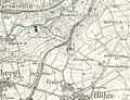
 Messtischblatt 4413 Werl 1927 Rechteck Ausschnitt Hilbeck Dorfkern.png 1,255 × 946; 1.83 MB
-
 Messtischblatt 4413 Werl 1927 Rechteck Ausschnitt Hilbeck.png 2,738 × 2,874; 10.92 MB
-
 Messtischblatt 4413 Werl 1927.png 8,407 × 9,806; 87.64 MB
-
 Michael Pikovsky, ארץ ישראל מפה חלקית (FL43908824 3930465).jpg 1,467 × 2,092; 1.2 MB
-
 Palestine 01 (FL184520030 0982468).jpg 13,894 × 14,836; 230.13 MB
-
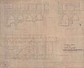 Plan and Sections of Church of St. John, Acre. 1927.jpg 8,686 × 7,048; 4.29 MB
-

-
 Plan Leningrad 1927 (add. to Travel Guide to Leningrad).jpg 5,180 × 8,071; 15.96 MB
-
 Plan Leningrad 1927.jpg 8,385 × 8,748; 16.47 MB
-
 Plan of Canberra, the Federal Capital of the Commonwealth of Australia LOC 2006629794.jpg 8,496 × 8,815; 10.22 MB
-
 Plan of Canberra, the Federal Capital of the Commonwealth of Australia LOC 2006629794.tif 8,496 × 8,815; 214.27 MB
-
 Rock Creek Park, Washington, D.C. - 1927 LOC 88693052.jpg 8,777 × 5,700; 5.31 MB
-
 Rock Creek Park, Washington, D.C. - 1927 LOC 88693052.tif 8,777 × 5,700; 143.13 MB
-
 Sala y gomez 1927.jpg 659 × 726; 110 KB
-
 Sir Patrick Hehir, Malaria in India Wellcome L0026242.jpg 1,554 × 1,344; 764 KB
-

-

-
 Skhematicheskai︠a︡ pochvennai︠a︡ karta Biro-Bidzhana. LOC 2018692332.jpg 5,993 × 5,095; 5.43 MB
-
 Skhematicheskai︠a︡ pochvennai︠a︡ karta Biro-Bidzhana. LOC 2018692332.tif 5,993 × 5,095; 87.36 MB
-
 Spezialkarte der Österreichisch-ungarischen Monarchie - Marburg 1927 sw.jpg 13,221 × 10,151; 112.61 MB
-
 Spezialkarte der Österreichisch-ungarischen Monarchie - Marburg 1927.jpg 13,221 × 10,151; 28.53 MB
-
 Spezialkarte der Österreichisch-ungarischen Monarchie - Pettau und Vinica 1927.jpg 13,267 × 10,127; 25.93 MB
-
 Spezialkarte der Österreichisch-ungarischen Monarchie - Pragerhof und Wind. Feistritz 1927.jpg 13,302 × 10,118; 25.4 MB
-
 The Mall and vicinity, Washington - 1927 LOC 88690912.jpg 15,077 × 7,630; 15.01 MB
-
 The Mall and vicinity, Washington - 1927 LOC 88690913.jpg 15,132 × 7,453; 15.45 MB
-
 The Mall and vicinity, Washington - 1927 LOC 88690913.tif 15,132 × 7,453; 322.66 MB
-
 Tour de France 1927.png 599 × 599; 337 KB
-
 Water Frontages- Elizabeth Bay - Rockley House & Grounds - Elizabeth Bay Rd, 1927.jpg 3,366 × 5,000; 3.91 MB
-
 Messtischblatt 4413 Werl 1927 Rechteck.png 6,728 × 6,481; 62.28 MB
-
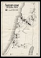
 ארץ-ישראל. Erez-Israel (FL79973375 4167486).jpg 6,692 × 9,233; 63.27 MB
-
 경성시가도 (1927).jpg 2,232 × 1,661; 4.71 MB


._LOC_2010593205.jpg)
.jpg)
.jpg)

_(14753218791).jpg)

.jpg)


.jpg)

.jpg)


.jpg)


.png)
,_Ausschnitt_Grube_Alexandria.jpg)


.jpg)
.jpg)

_-_Nustadskaya_Street.jpg)
.jpg)


.jpg)
.jpg)